Area 6,914 km² Region Arequipa Region | UBIGEO 0404 | |
 | ||
Website www.municipiocastilla.gob.pe | ||
Castilla Province is one of eight provinces in the Arequipa Region of Peru. It was named after Ramón Castilla.
Contents
Map of Castilla Province, Peru
Geography
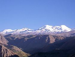
The Chila mountain range traverses the province. One of the highest mountains of the province is Coropuna at 6,425 m (21,079 ft) above sea level. Other mountains are listed below:
Machuqucha is one of the largest lakes of the province.
Political division
The province is divided into fourteen districts which are, with its capital in parenthesis:
Ethnic groups
The province is inhabited by indigenous citizens of Aymara and Quechua descent. Spanish, however, is the language which the majority of the population (79.72%) learnt to speak in childhood, 18.52% of the residents started speaking using the Quechua language and 1.51% using Aymara (2007 Peru Census).
References
Castilla Province Wikipedia(Text) CC BY-SA
