
Founded by Luis Enrique Area 139.4 km² Population 8,400 (2015) | Founded 2 October 1600 Elevation 2,400 m (7,900 ft) Local time Sunday 9:51 AM | |
 | ||
Weather 13°C, Wind E at 11 km/h, 66% Humidity | ||
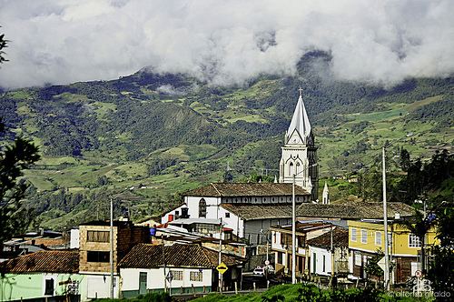
Chipaque is a municipality and town in the Eastern Province of the department of Cundinamarca, Colombia. The municipality of 139.45 square kilometres (53.84 sq mi) is located at an altitude of 2,400 metres (7,900 ft) in the Eastern Ranges of the Colombian Andes with its westernmost part situated in the Eastern Hills of Bogotá. The Colombian capital is 27 kilometres (17 mi) west of Chipaque. Chipaque borders Bogotá's southern locality Usme in the west. To the east, Chipaque borders Cáqueza, in the south Une and in the north Ubaque. The average temperature is 13 °C (55 °F).
Contents
Map of Chipaque, Cundinamarca, Colombia
Etymology
The name Chipaque is derived from the word Chipapabacue, Muysccubun for "Forest of our ancestors".
Geology
The Chipaque Formation, consisting of organic shales and sandstone beds, is named after Chipaque. The Páramo de Cruz Verde is located in the northern part of the municipality.
History
Before the Spanish conquest of the Muisca, Chipaque was inhabited by the indigenous Muisca, organised in their loose Muisca Confederation. Chipaque was part of the cacicazgo of Ubaque. During the conquest, main conquistador Gonzalo Jiménez de Quesada sent Juan Tafur eastward. In 1538, he established the first church in Chipaque.
Modern Chipaque was founded on October 2, 1600 by Luis Enrique.
Economy
Main activities of Chipaque are livestock farming and agriculture, with potatoes (45 %) and onions (25 %) as most important products.