Prominence 45 m (148 ft) Topo map NTS 92I/13 | Elevation 1,725 m Range Marble Range | |
 | ||
First ascent 1957 Hank Mather; Elfida Pigou | ||
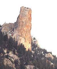
Chimney Rock (K'lpalekw in Secwepemctsin, meaning "Coyote's Penis") is a limestone formation in Marble Canyon, midway between the towns of Lillooet and Cache Creek in British Columbia, Canada.
Map of Chimney Rock, Squamish-Lillooet B, BC, Canada
References
Chimney Rock (Canada) Wikipedia(Text) CC BY-SA
