
Country Ecuador Vehicle registration B Area 6,500 km² | Legal establishment June 25, 1826 Time zone ECT (UTC-5) Website www.chimborazo.gov.ec Local time Sunday 12:46 AM | |
 | ||
Weather 12°C, Wind SW at 6 km/h, 92% Humidity Colleges and Universities Polytechnic School of Chimborazo, Universidad Nacional de Chimborazo Clubs and Teams C.D. Olmedo, Club Deportivo Mavort Points of interest Chimborazo, Reserva de Produccion Faunistic, Riobamba, La Nariz del Diablo, El Altar | ||
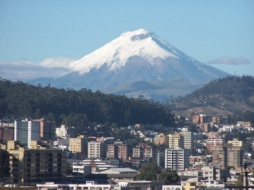
Riobamba sultan of the andes chimborazo province ecuador
Chimborazo ([tʃimboˈɾaso]) is a province in the central Ecuadorian Andes. It is a home to a section of Sangay National Park. The capital is Riobamba. The province contains Chimborazo (6,267 m), Ecuador's highest mountain.
Contents
- Riobamba sultan of the andes chimborazo province ecuador
- Map of Chimborazo Province Ecuador
- Cantons
- Demographics
- References
Map of Chimborazo Province, Ecuador
Cantons
The province is divided into 10 cantons. The following table lists each with its population at the time of the 2001 census, its area in square kilometres (km²), and the name of the canton seat or capital.
Town's in the province include Cacha.
Demographics
Ethnic groups as of the Ecuadorian census of 2010:
References
Chimborazo Province Wikipedia(Text) CC BY-SA