
Constituted December 18, 1982 Postal code(s) G0P 1J0 Area 117 km² Local time Saturday 7:34 AM Area code 819 | Settled 1835-1849 Time zone EST (UTC−5) Population 891 (2011) Province Québec | |
 | ||
Weather -21°C, Wind NW at 21 km/h, 58% Humidity RCM Arthabaska Regional County Municipality | ||
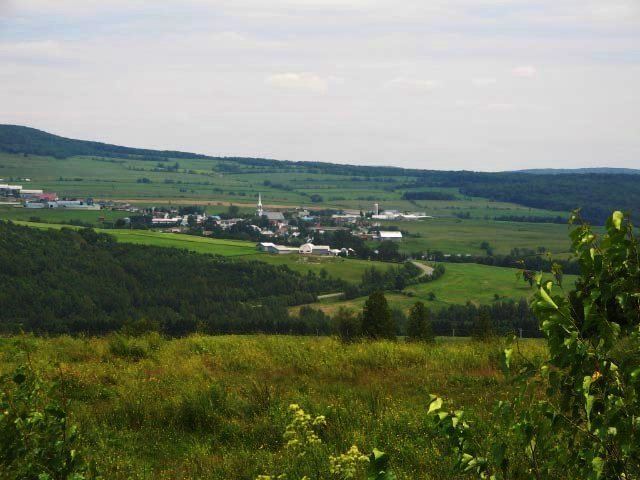
Chesterville is a municipality in the Arthabaska district of the Centre-du-Québec (Bois-Francs) region of Quebec, on Route 161 approximately 130 kilometres (81 mi) northeast of Montreal.
Contents
Map of Chesterville, QC, Canada
Geography
The town's mountainous terrain in the heart of the Canadian Appalachians has earned it the nickname of "Quebec's little Switzerland," and boasts a picturesque location adjacent to the northern Nicolet river.
History
The first settlers to the area arrived in 1835, but colonization actually began in spring 1849 with the establishment of a Catholic parish.
Demographics
The principal source of income in Chesterville is agriculture and forest explotation.
Attractions
The free annual Symposium L'Accueil des Grands Peintres (art symposium) attracts many art lovers and features exhibits, artist conferences, workshops, local fare, and other cultural activities.
«Clairière - Art et Nature» is a 2 km forest path and natural amphitheatre dedicated to Professional site specific visual arts and musical concerts. Annual week-ends events are presented in August and September; they are open to the public. [1]