
 | ||
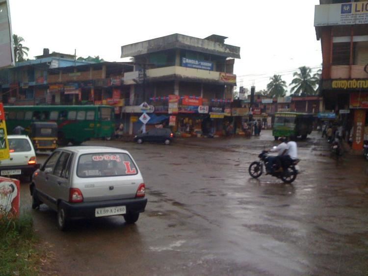
Cherupuzha is primarily an agriculture-centered city in northern Kerala. Cherupuzha town, which is the headquarters of the panchayat, is located about 30 kilometers east of Payyannur and 35 kilometers west of Nileshwar.
Contents
- History
- Geography
- River Tejaswini
- Other Towns Near Cherupuzha
- Places of worship in Cherupuzha
- Transportation
- Hanging Bridge
- Roads
- Ezhimla Payyannur Cherupuzha Thalakkaveri Bhagamandala Bengaluru road
- Cherupuzha Prapoyil Chathamangalam Parappa Karthikapuram Road Bye pass Road for Hill Highway
- How To Reach Cherupuzha
- References
History
Cherupuzha and its surrounding areas was ruled by many royal dynasties in the past, including the Mooshika dynasty of Ezhimala, Chirakkal Dynasty of Kolathunadu, Tipu Sultan of the Kingdom of Mysore, before it became a part of the British Raj. The original inhabitants of the area were primarily Hindus. Later on this region gained a sizable Christian and Muslim population. The economy was agrarian with strong feudal system - Janmi-Kudiyan system - permeating everyday life.
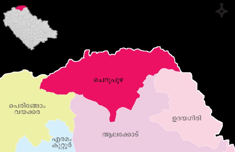
Geography
Cherupuzha is a hilly village on the eastern side of Kannur district. The terrain is undulating in nature and the extreme eastern side has forests bordering Karnataka state.
River Tejaswini
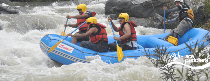
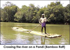
River Tejaswini, also called Kariamkode, which is comparatively small among 44 rivers of Kerala. It originates from Brhmagiri Hills of Coorg forest in Karnataka, enters Kerala near Pulingome, flows through the districts of Kannur and Kasargod and meets the Arabian Ocean, near Nileshwaram as a part of Valiyaparamba Backwaters. Tejaswini, which is 64 km long, do have a rafting stretch of 20 km with plenty of rapids extending up to class-3.
Other Towns Near Cherupuzha
Satellite towns include Pulingome,Koluvally, Padichal, Chittarikkal, Alakkode, Kozhichal, Thirumeni, Thabore and Chathamangalam (Kannur). These population centers are well connected to Cherupuzha by road.
Places of worship in Cherupuzha
Transportation
The national highway passes through Perumba junction. Goa and Mumbai can be accessed on the northern side and Cochin and Thiruvananthapuram can be accessed on the southern side. The road to the east of Iritty connects to Mysore and Bangalore. The nearest railway station is Payyanur on Mangalore-Palakkad line. Trains are available to almost all parts of India subject to advance booking over the internet. There are airports at Mattanur, Mangalore and Calicut. All of them are international airports but direct flights are available only to Middle Eastern countries.
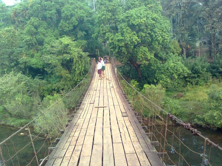
Hanging Bridge
The Major attraction in Cherupuzha is a hanging bridge in Tejaswini river (also known as karyamkode puzha) which connects both Kasaragod and Kannur districts.
Roads
All the other roads in this area were built by the people themselves. The roads, Cherupuzha-Pulingome – Kottathalachi, Edavaramba – Koombankunnu, Kariyakkara – Koombankunnu, Vazhakkundam – Churappadavu, Chunda – Vilakkuvettam and Umayanchal – Kottathalachi are examples of the collective effort of people of Cherupuzha and Pulingome. Another important road in the area is Cherupuzha-Thirumeni road which is of a length of 7 kilometers. From Thirumeni, one can reach to its outskirts like Chathamangalam, Thabore, Muthuvom and Korali.
Both private and public transport buses are available from Cherupuzha to Cannannore, Calicut, Cochin and Bangalore.
Ezhimla-Payyannur-Cherupuzha-Thalakkaveri-Bhagamandala-Bengaluru road
A new bridge has already been constructed over Pulingome river near Cherupuzha, connecting Kerala and Karnataka. Talks are on between Karnataka, Kerala and central Governments on this project. If this road became a reality, the distance to Bangalore and Mysore would be reduced by more than 60 kilometers also 120 kilometers between Kannur and Bangalore.
Cherupuzha-Prapoyil-Chathamangalam-Parappa-Karthikapuram Road : Bye-pass Road for Hill Highway
This road,though development is still underway, is very significant because it connects Cherupuzha to places like Karthikapuram, Parappa, Neduvode and Rayarome at the shortest distance. This is the only road that goes through the common meeting place of Cherupuzha, Alakode and Udayagiri panchayaths. Efforts are on to renovate the road completely and make it the bye-pass of Alakode-Therthaly-Cherupuzha Road. The advantage is in case of any complication on the major road, the bye-pass can be used.
If developed properly, additional long route buses can make trips covering places like Prapoyil, Thirumeni, Chathamangalam, Parappa & Karthikapuram. All these places have only local bus services now and can act as a proper alternate route for the HIll Highway.
How To Reach Cherupuzha
Cherupuzha is 71 km from Kannur and 30 km from Payyanur. Buses ply from Kannur and Payyanur to Cherupuzha very frequently.