
Founded July 13, 1846 Congressional district 5th Website www.co.cherokee.tx.us | Area 2,751 km² Population 50,878 (2013) | |
 | ||
Cities Jacksonville, Rusk, Alto, New Summerfield, Cuney, Gallatin, Wells, Weeping Mary, Texas, Shadybrook, Texas Colleges and Universities Lon Morris College, Jacksonville College, Baptist Missionary Associati Points of interest Texas State Railroad, Cherokee Trace Drive‑Thr, George C Davis Site, Loves Lookout Park, Jim Hogg Park | ||
Cherokee County is a county located in the U.S. state of Texas. As of the 2010 census, its population was 50,845 . The county seat is Rusk. The county was named for the Cherokee, who lived in the area before being expelled in 1839. Rusk, the county seat, is 130 miles southeast of Dallas and 160 miles north of Houston.
Contents
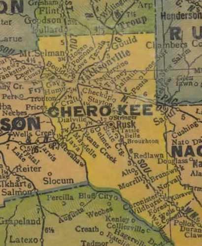
- Map of Cherokee County TX USA
- Native Americans
- Early exploration and settlers
- County established and growth
- Geography
- Major highways
- Adjacent counties
- National protected area
- Demographics
- Media
- Towns
- Census designated places
- Ghost towns
- References
Map of Cherokee County, TX, USA
Cherokee County comprises the Jacksonville, TX Micropolitan Statistical Area, which is also included in the Tyler-Jacksonville, TX Combined Statistical Area.
Native Americans
The Hasinai group of the Caddo tribe built a village in the area about AD 800. and continued to live in the area until the 1830s, when they migrated to the Brazos River. The Federal government moved them to the Brazos Indian Reservation in 1855 and later to Oklahoma.
The Cherokee, Delaware, Shawnee, and Kickapoo Native American people began settling in the area circa 1820. The Texas Cherokee tried unsuccessfully to gain a grant to their own land from the Mexican government.
Sam Houston, adopted son of Chief Oolooteka (John Jolly) of the Cherokee, negotiated the January 14, 1836, treaty between Chief Bowl of the Cherokee and the Republic of Texas. On December 16, 1837, the Texas Senate declared the treaty null and void, and encroachment of Cherokee lands continued. On October 5, 1838, Indians massacred members of the Isaac Killough family at their farm northwest of the site of present Jacksonville, leading to the Cherokee War of 1839 and the expulsion of all Indians from the land which was to become the county of Cherokee.
Early exploration and settlers
Domingo Terán de los Ríos and Father Damián Massanet explored the area on behalf of Spain in 1691. Louis Juchereau de St. Denis began trading with the Hasinais in 1705. Nuestro Padre San Francisco de los Tejas Mission was originally established in 1690 but was re-established in 1716 by Captain Domingo Ramon. It was abandoned again because of French incursions and re-established in 1721 by the Marques de San Miguel de Aguyao.
In 1826, empresario David G. Burnet received a grant from the Coahuila y Tejas legislature to settle 300 families. then. The settlers were mostly from the southern states and brought with that lifestyle with them. By contracting how many families each grantee could settle, the government sought to have some control over colonization.
County established and growth
Cherokee County was formed from land given by Nacogdoches County in 1846. It was organized the same year. The town of Rusk became the county seat.
Cherokee County voted in favor of secession from the Union, during the build-up to the Civil War.
In 1872, the International – Great Northern Railroad caused Jacksonville to relocate two miles east, to be near the tracks. The Kansas and Gulf Short Line Railway was built north-to-south through the county between 1882 and 1885. The Texas and New Orleans Railroad in 1905, and the Texas State Railroad in 1910, each gave rise to new county towns along their tracks.
Geography
According to the U.S. Census Bureau, the county has a total area of 1,062 square miles (2,750 km2), of which 1,053 square miles (2,730 km2) is land and 9.3 square miles (24 km2) (0.9%) is water.
Major highways
Adjacent counties
National protected area
Demographics
As of the census of 2000, there were 46,659 people, 16,651 households, and 12,105 families residing in the county. The population density was 44 people per square mile (17/km²). There were 19,173 housing units at an average density of 18 per square mile (7/km²). The racial makeup of the county was 74.34% White, 15.96% Black or African American, 0.47% Native American, 0.40% Asian, 0.06% Pacific Islander, 7.43% from other races, and 1.34% from two or more races. 13.24% of the population were Hispanic or Latino of any race.
There were 16,651 households out of which 33.40% had children under the age of 18 living with them, 55.70% were married couples living together, 12.80% had a female householder with no husband present, and 27.30% were non-families. 24.20% of all households were made up of individuals and 11.90% had someone living alone who was 65 years of age or older. The average household size was 2.63 and the average family size was 3.11.
In the county, the population was spread out with 26.30% under the age of 18, 9.30% from 18 to 24, 27.40% from 25 to 44, 21.90% from 45 to 64, and 15.10% who were 65 years of age or older. The median age was 36 years. For every 100 females there were 101.00 males. For every 100 females age 18 and over, there were 99.00 males.
The median income for a household in the county was $29,313, and the median income for a family was $34,750. Males had a median income of $26,410 versus $19,788 for females. The per capita income for the county was $13,980. About 13.70% of families and 17.90% of the population were below the poverty line, including 23.30% of those under age 18 and 15.10% of those age 65 or over.
Media
Cherokee County is part of the Tyler/Longview/Jacksonville DMA. Local media outlets are: KLTV, KTRE-TV, KYTX-TV, KFXK-TV, KCEB-TV, and KETK-TV.
Newspapers in the county include the Jacksonville Progress, which publishes three editions a week in Jacksonville, and the weekly Cherokeean Herald in Rusk.