
Area 899.8 km² | Administrative divisions 4 eup, 3 myeon | |
 | ||
Dialect Gangwon Province, South Korea | ||
Cheorwon County (Cheorwon-gun [tɕʰʌɾwʌn ɡun]), also spelt Chorwon, is a county in Gangwon Province, South Korea. It is located right next to the border with North Korea.
Contents
Map of Cheorwon-gun, Gangwon-do, South Korea
History
Korean War
Following the Division of Korea in 1945, all of Cheorwon County was part of North Korea.
During the Korean War the region changed hands several times during the UN invasion of North Korea and the Chinese invasion of South Korea, by 1951 the frontlines had stabilized, cutting across Cheorwon County and the area became part of the Iron Triangle battlefield. The Battle of White Horse took place north of Cheorwon town from 6–15 October 1952 and the Battle of Triangle Hill took place north of Gimhwa-eup from 14 October - 25 November 1952.
Following the signing of the Korean Armistice Agreement, the Korean Demilitarized Zone cut Cheorwon County in two, creating Cheorwon County in South Korea and Chorwon County in North Korea.
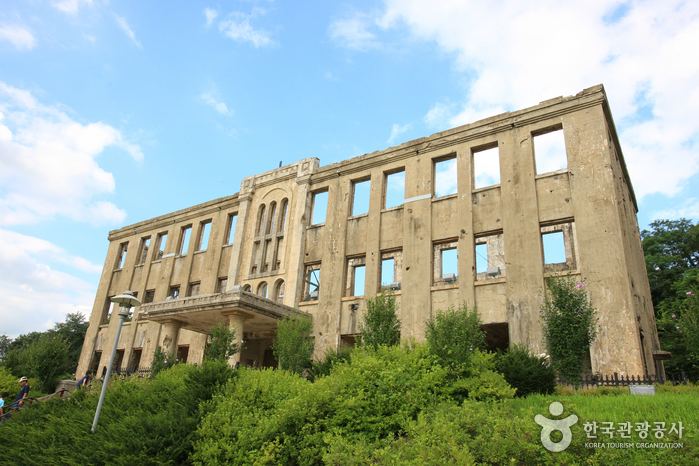
A number of Korean War sites in Cheorwon County are now tourist destinations including the former Woljeong-ri Station, the former Korean Workers’ Party Office, the Iron Triangle Tourist Office, the Second Incursion Tunnel and the Cheorwon Peace Observatory
Symbol
Location
Cheorwon plays an important role in providing passage from Seoul to Wonsan and Kumgangsan
Since the expansion of the 43 National Road which connects Cheorwon and Seoul, the ease of transportation has been improved greatly.