
Country United States FIPS code 36-15110 Elevation 293 m Population 11,252 (2010) | State New York Time zone Eastern (EST) (UTC-5) GNIS feature ID 0978819 Local time Friday 11:21 PM | |
 | ||
Weather -10°C, Wind W at 18 km/h, 65% Humidity | ||
Chenango is a town in Broome County, New York, United States. The population was 11,252 at the 2010 census.
Contents
- Map of Chenango NY USA
- History
- Geography
- Demographics
- Communities and locations in the Town of Chenango
- References
Map of Chenango, NY, USA
The town is in the eastern part of the county, northeast of Binghamton.
History
The area was first settled around 1787, and the Town of Chenango was established in 1791 before the formation of Broome County. It is one of the original towns of the county, from which other towns were later formed.
Geography
According to the United States Census Bureau, the town has a total area of 34.3 square miles (88.8 km2), of which 33.8 square miles (87.6 km2) is land and 0.42 square miles (1.1 km2), or 1.27%, is water.
The Chenango River defines the eastern town line.
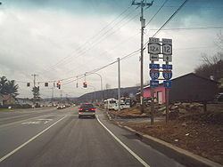
Interstate 81, U.S. Route 11, and New York State Route 12 pass through the town.
Demographics
As of the census of 2000, there were 11,454 people, 4,519 households, and 3,271 families residing in the town. The population density was 337.7 people per square mile (130.4/km²). There were 4,734 housing units at an average density of 139.6 per square mile (53.9/km²). The racial makeup of the town was 97.44% White, 0.58% African American, 0.10% Native American, 0.53% Asian, 0.02% Pacific Islander, 0.38% from other races, and 0.94% from two or more races. Hispanic or Latino of any race were 0.93% of the population.
There were 4,519 households out of which 32.4% had children under the age of 18 living with them, 59.2% were married couples living together, 9.5% had a female householder with no husband present, and 27.6% were non-families. 23.0% of all households were made up of individuals and 10.2% had someone living alone who was 65 years of age or older. The average household size was 2.53 and the average family size was 2.98.
In the town, the population was spread out with 25.2% under the age of 18, 6.5% from 18 to 24, 26.2% from 25 to 44, 27.2% from 45 to 64, and 14.9% who were 65 years of age or older. The median age was 40 years. For every 100 females there were 97.9 males. For every 100 females age 18 and over, there were 93.7 males.
The median income for a household in the town was $47,342, and the median income for a family was $54,381. Males had a median income of $39,290 versus $27,645 for females. The per capita income for the town was $22,431. About 4.6% of families and 6.2% of the population were below the poverty line, including 5.5% of those under age 18 and 7.2% of those age 65 or over.