
Length 9.0 mi (14.5 km) | ||
 | ||
Owner City of PhiladelphiaSpringfield Township | ||
Cheltenham Avenue is a major east-west road in Southeastern Pennsylvania. It is served by many SEPTA bus routes, trolleys, regional rail, and subway. Cheltenham Avenue is designated quadrant route 2035 in its western section. It also is a major borderline; it defines the border between Springfield and Cheltenham townships, and Cheltenham Township and the City of Philadelphia, with the latter also being the Montgomery County and Philadelphia County.
Contents
Route Description
Cheltenham Avenue has two sections, divided by Tookany Creek and SEPTA's Fox Chase regional rail line.
Western Section
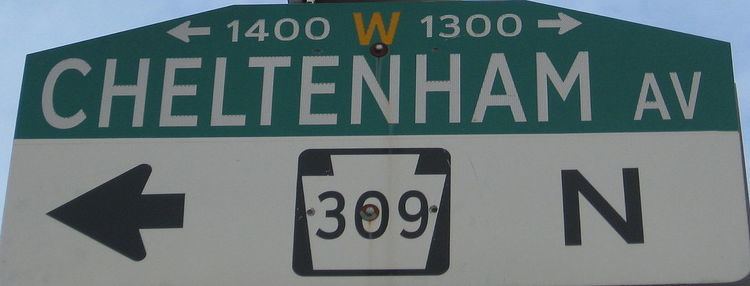
Cheltenham Avenue begins in Springfield Township at the intersection with Paper Mill Road, just a little ways from the 309 interchange at an elevation of 244 feet above sea level. It runs southeast up a hill where it passes by LaSalle College High School, by that time the road now forms the border between Springfield and Cheltenham Township. Following several steep ascends and climbs, Springfield Township ends on the south side of the road, and the road begins as a border between Cheltenham and the City of Philadelphia, right near the Holy Sepulchre Cemetery.
Following a busy intersection with Easton Road, Cheltenham Avenue passes the Cedarbrook Shopping Center, and the Towers at Wyncote. Cheltenham Avenue then has another major intersection with Ogontz Avenue. This point begins the west end of the 309 overlap, as well as the end of the Fort Washington Expressway. The Cheltenham Square Mall also sits at the northeast corner of this intersection, as well as the Ogontz-Cheltenham Bus Depot, a major terminus for several SEPTA bus routes.
After crossing over Washington Lane, Cheltenham Avenue passes many strip malls and busy residential neighborhoods. After passing a small cemetery on the right (where the skyline of Philadelphia is just visible), Cheltenham Avenue intersects with the northern terminus of Broad Street. Immadietly following the Broad Street intersection is the southern terminus of 309. Soon after, Cheltenham Avenue intersects 611 and historic Old York Road.
After these intersections, Cheltenham Avenue goes under several overpasses and winds its way to its at Tookany Creek Parkway/Crescentville Road, near the Tookany Creek. Final elevation is 66 feet above sea level.
Eastern Section
Cheltenham Avenue begins again in the Lawndale section of the city, just east of the Fox Chase Line. It continues southeast through and intersects with several major streets such as Rising Sun Avenue and Tabor Avenue, at which it intersects with a US Defense Industrial Supply building and Fels Samuel High School.
After several blocks of row houses, Cheltenham Avenue hits Oxford Circle, a major intersection of the Roosevelt Boulevard (which carries US 1 and US 13), Oxford Avenue (Pennsylvania Route 232), and Castor Avenue. It then continues through more row houses and passes to the northeast of Frankford Transportation Center, a major SEPTA stop and terminal for the Market-Frankford Line.
After passing by several cemeteries and Wissinoming Park, Cheltenham Avenue has major intersections with both Harbison Avenue and Torresdale Avenue. Cheltenham Avenue then winds through a few more blocks of houses, before it comes to its terminus at Keystone Street, just west of Amtrak's Northeast Corridor tracks, Interstate 95, and the Delaware River. Final elevation is 29 feet above sea level.
Attractions
Public Transportation
Cheltenham Avenue is a major thruway for many SEPTA bus, Regional Rail, and Subway routes.
Trackless Trolley
Subway
Regional Rail
Education
Neighborhoods
History
The Philadelphia Rapid Transit Company (later became SEPTA) ran many trollies along Cheltenham Avenue, including the famous Route 6 which began service in 1907. It carried many Philadelphians from the Olney Transportation Center to Willow Grove Amusement Park. Trolley service from Cheltenham Avenue to Willow Grove ended in 1958, and the entire route was shut down and replaced by buses in 1985. Today, the route is covered by bus route 22.