
- elevation 1,000 ft (305 m) - elevation 0 ft (0 m) Length 185 km Country United States of America | Basin area 6,889 km² Discharge 181.9 m³/s | |
 | ||
- right South Fork Chehalis River, Newaukum River, Skookumchuck River, Satsop River, Wynoochee River, Wishkah River - average 6,425 cu ft/s (182 m/s) - max 47,000 cu ft/s (1,331 m/s) Mouths Grays Harbor, Pacific Ocean | ||
The Chehalis River (/ʃəˈheɪlᵻs/ shə-HAY-lis) is a river in Washington in the United States. It originates in several forks in southwestern Washington, flows east, then north, then west, in a large curve, before emptying into Grays Harbor, an estuary of the Pacific Ocean.
Contents
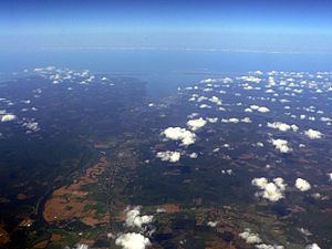
- Map of Chehalis River Washington USA
- CourseEdit
- December 3 2007 floodsEdit
- January 7 2009 floodsEdit
- References
Map of Chehalis River, Washington, USA
CourseEdit
The Chehalis River begins at the confluence of the West Fork Chehalis River and East Fork Chehalis River, in southwestern Lewis County. From there the Chehalis flows north and east, collecting tributary streams that drain the Willapa Hills and other low mountains of southwestern Washington. The South Fork Chehalis River joins the main river a few miles west of the city of Chehalis. The Newaukum River joins the Chehalis River at Chehalis, after which the river turns north, flowing by the city of Centralia, where the Skookumchuck River joins. After Centralia, the Chehalis River flows north and west, collecting tributaries such as the Black River, which drains the Black Hills to the north, then in the Chehalis Gap collects the Satsop River and Wynoochee River, which drain the southern part of the Olympic Mountains.
The Wynoochee River joins the Chehalis near Montesano, after which the Chehalis River becomes increasingly affected by tides and widens into Grays Harbor estuary. The city of Aberdeen lies at the mouth of the Chehalis River. Just east of Aberdeen, the Wishkah River joins the Chehalis, and just west, between Aberdeen and Hoquiam, the Hoquiam River joins. At this point the river has become Grays Harbor. Before the estuary of Grays Harbor empties into the Pacific Ocean, the Humptulips River joins.
December 3, 2007 floodsEdit
During the Great Coastal Gale of 2007, a twenty-mile (32 km) stretch of Interstate 5 was closed between exits 68 and 88 because of flooding from the Chehalis River, causing the roadway to be under about 10 feet (3.0 m) of water. The recommended detour added about four hours and 280 miles (450 km). It was not expected to reopen for several days. However, upon breaching a dike on Dec. 5, 2007, the water receded quicker than anticipated. Amtrak train service between Portland, Oregon and Vancouver, British Columbia was also disrupted. Washington governor Chris Gregoire declared a state of emergency on December 3.
January 7, 2009 floodsEdit
During the January 7, 2009 Pacific Northwest storms, a twenty-mile (32 km) stretch of Interstate 5 was closed between exits 68 and 88 because of flooding from the Chehalis River, causing the roadway to be under several feet of water. Since the main east/west mountain passes were also closed during this event, the flooding from the Chehalis river essentially cut off traffic to the Puget Sound area and no detour was available.