
 | ||
Bridges Chef Menteur Bridge, CSX Chef Menteur Pass Bridge | ||
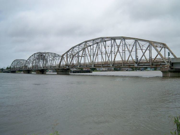
Apnola chef menteur pass train bridge
The Chef Menteur Pass is a narrow natural waterway which, along with the Rigolets, connects Lake Pontchartrain and Lake Borgne in New Orleans, Louisiana. It begins at 30°5′45″N 89°48′52″W and follows a generally southeastward course.
In the days of sailing ships, much commerce from the Gulf of Mexico sailed through here and the Rigolets into Lake Pontchartrain to New Orleans and surrounding communities.
Chef Menteur Pass was long guarded by Fort Macomb, now an abandoned ruin on the western side of the Pass. Two bridges span the Pass. The automobile bridge, constructed in 1929, carries U.S. Highway 90; the portion of this road between central New Orleans and the pass was long known as "Chef Menteur Road" before the route became a U.S. highway. Portions are still known as "Chef Menteur Highway." The CSX railroad bridge also spans Chef Menteur Pass a short distance south of the highway bridge.
The Lake Catherine neighborhood of New Orleans is to the east side of the pass. The Venetian Isles neighborhood of New Orleans is to the west of the pass.
This area was hit hard by Hurricane Katrina in 2005. The Highway 90 bridge was closed for nearly a year, from the day that the hurricane struck on 29 August 2005 until repairs allowed it to reopen on 11 August 2006.