
rural settlement 17 Rural localities 171 | Urban-type settlements 1 Area 1,179 km² | |
 | ||
Administrative center urban-type settlement of Kugesi | ||
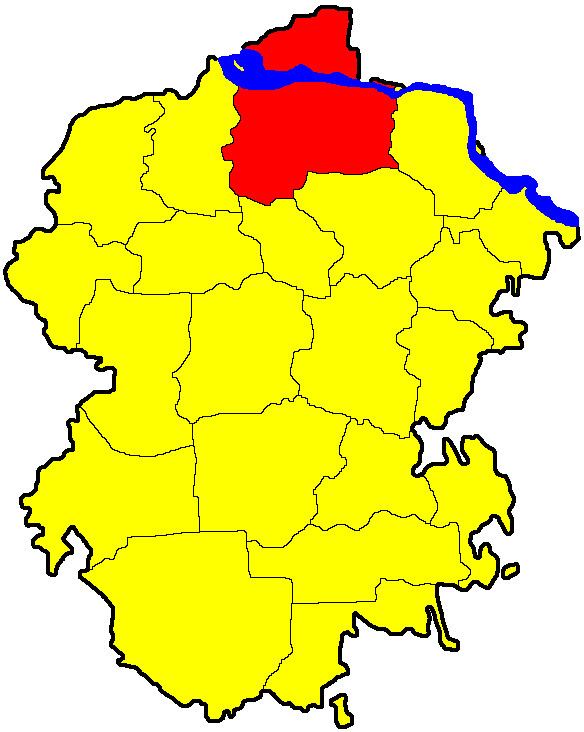
Cheboksarsky District (Russian: Чебокса́рский райо́н; Chuvash: Шупашкар районĕ, Shupashkar rayonĕ) is an administrative and municipal district (raion), one of the twenty-one in the Chuvash Republic, Russia. It is located in the north of the republic and borders with the Mari El Republic in the north, Mariinsko-Posadsky District in the east, Tsivilsky and Krasnoarmeysky Districts in the south, and with Morgaushsky District in the west. The area of the district is 1,178.8 square kilometers (455.1 sq mi). Its administrative center is the urban locality (an urban-type settlement) of Kugesi. Population: 62,920 (2010 Census); 58,766 (2002 Census); 57,107 (1989 Census).
Contents
Map of Cheboksarskiy r-n, Chuvashia Republic, Russia
Geography
The Volga River parts the district into a smaller area in the north and a larger southern area which contains the majority of the population.
History
The district was established on September 5, 1927.