
Country Thailand Postal code 36130 Area 731 km² | Time zone THA (UTC+7) Geocode 3606 Province Chaiyaphum Province | |
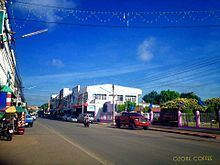 | ||
Chatturat (Thai: จัตุรัส) is a district (Amphoe) of Chaiyaphum Province, northeastern Thailand.
Contents
Map of Chatturat District, Chaiyaphum, Thailand
History
Phraya Narin Songkhram (Thongkham) led people from Vientiane to establish a new town at Mueang Narai, in the modern-day Tambon Cho Ho, Mueang Nakhon Ratchasima district. Later they moved to a fertile square pond, decided to stay there and named the new town Ban Si Mum. Now it is Ban Sa Si Mum, Tambon Ban Kok, within the modern-day district. In 1826 Phraya Narin Songkhram moved the center of the town northwards to Tambon Nong Bua Yai, around 8 km from the old town. When he died, his son Mr. Saek travelled to Bangkok to receive the royal command documents for his appointment as governor. However he died on the way to Bangkok, so Mr. Bun Hao received the royal command instead. After that he moved the center of town toward the southwest at Tambon Ban Kok because of the old location was prone to flooding. When Phraya Narin Songkhram (Bun Hao) died, his son Thongdi received the royal command to be the governor.
Geography
Neighboring districts are (from the north clockwise) Ban Khwao, Noen Sa-nga of Chaiyaphum Province, Phra Thong Kham and Dan Khun Thot of Nakhon Ratchasima Province, and Bamnet Narong, Sap Yai and Nong Bua Rawe of Chaiyaphum again.
Administration
The district is subdivided into 9 subdistricts (tambon), which are further subdivided into 115 villages (muban). Nong Bua Khok has township (thesaban tambon) status.
Missing numbers are tambon which now form Noen Sa-nga and Sap Yai