
Population 2,538 (2011) Civil parish Charfield Local time Friday 4:45 AM | OS grid reference ST7292 | |
 | ||
Weather 6°C, Wind SE at 14 km/h, 91% Humidity | ||
Charfield is a village and civil parish in South Gloucestershire, England lying near the Little Avon River and south-west of the town of Wotton-under-Edge. Charfield is situated near the villages of Falfield and Cromhall.
Contents
- Map of Charfield Wotton under Edge UK
- Village
- Governance
- Railway
- Railway history
- Charfield Memorial Hall and Playing Field
- References
Map of Charfield, Wotton-under-Edge, UK
Village
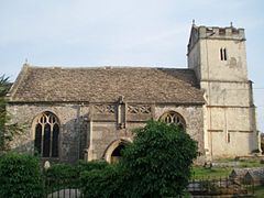
Charfield is a medium-sized village of about 2500 residents (2001 census), with three pubs (Pear Tree, Railway Tavern and The Plough Inn), a convenience store with Post Office called Steve's Shop, two hairdressers, and a petrol station. It has two churches, and a large Land Rover dealership (on the site of the former railway station) with a Tyre/MOT service centre to one side. There are four main housing areas called, Farm Lees, Longs View, Manor lane, and Woodlands. The school which has a good reputation has around 250 students and recently have opened a new play area. Near to the school there is a river. This river is actually in Huntingford and Damery. Near the north end of the town is the South Gloucestershire border with Gloucestershire, the Bennett's farm, and a mile or so from one of the local employers, Renishaw.
Governance
An electoral ward with the same name exists. This ward starts in the east in Charfield and then stretches west to Falfield. The total ward population taken at the 2011 census was 4,678.
The parish council has responsibility for local issues, including setting an annual precept (local rate) to cover the council's operating costs and producing annual accounts for public scrutiny. The parish council evaluates local planning applications and works with the local police, district council officers, and neighbourhood watch groups on matters of crime, security, and traffic. The parish council's role also includes initiating projects for the maintenance and repair of parish facilities, such as the Memorial Hall and playing field (and playground), as well as consulting with the district council on the maintenance, repair, and improvement of highways, drainage, footpaths, public transport, and street cleaning. Conservation matters (including trees and listed buildings) and environmental issues are also of interest to the council.
The parish council is also a burial authority, and has its own burial ground located in nearby Churchend.
Railway
The Bristol-Birmingham main railway line runs through the village (part of the Cross Country Route). Charfield railway station is currently disused (it was closed in January 1965 but still stands), although discussions continue about the viability of re-opening it. The costs of re-opening would be shared between Gloucestershire and South Gloucestershire Councils since, although the station would be in South Gloucestershire, the nearby Gloucestershire town of Wotton-under-Edge would be a principal beneficiary.
The railway line marks the division of the village between two totally different telephone areas (01453-54x based on Wotton-under-Edge, and 01454-26x based on Falfield). The village is on the outer limits of both areas and so was only recently able to get broadband. The village has now been Fibre enabled, allowing FTTC connections.
Railway history
The Charfield railway disaster was a fatal train crash which occurred on 13 October 1928. The Leeds to Bristol LMS night mail train crashed under a road bridge near Charfield railway station killing 15 and injuring 23. Amongst the dead were two children whose remains remain unidentified.
Charfield Memorial Hall and Playing Field
Charfield Memorial Hall and Playing Field is in the centre of Charfield. The Hall has recently been refurbished and the play area upgraded with new equipment.