
Time zone ETZ (UTC-5) Population 98,310 (2010) Local time Thursday 4:24 PM | Area 3,995 km² | |
 | ||
Weather 29°C, Wind N at 14 km/h, 61% Humidity | ||
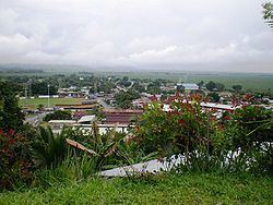
Changuinola District is a district (distrito) of Bocas del Toro Province in Panama. The population according to the 2010 census was 98.310 The district covers a total area of 3,995 km². The capital lies at the city of Changuinola. Major industries include tourism and agriculture.
Contents
Map of Changuinola District, Panama
Administrative divisions
The district is divided administratively into the following corregimientos:
Changuinola, Almirante, Guabito, Teribe, Valle del Risco, El Empalme, Las Tablas, Valle de Agua Arriba, Nance de Risco, Las Delicias, Cochigro and La Gloria.
In 2015, Panamanian National Assembly authorized the split of Almirante Corregimiento to form a new District, but may require years for changes take effect.
Climate
Changuinola has a coastal location with a tropical climate. The area does not have a predictable dry season. The driest times are late August to mid-October, February, and March. Changuinola is humid. Thundershowers and heavy rain are common. Normal temperatures are consistent all year (Hi: 80°-84°F, low: 71°-75°F). Due to its low latitude, sunrise is around 6 AM, and sunset is around 6 PM local time. These times vary slightly during the year. Weather data is collected at Captain Manuel Nino International Airport in Changuinola.