
Established 555 Elevation 2 m Population 16,723 (Apr 2013) | Region Gyeongnam Time zone UTC+09:00 Area 61.42 km² | |
 | ||
Administrative divisions 17 Legal village 법정리, 31 administrative villages 행정리, 161 neighborhoods 반 Website Changnyeong City Office | ||
Changnyeong-eup (창녕읍, 昌寧邑) is a town (eup) in the administrative county of Changnyeong, South Gyeongsang Province, in South Korea.
Contents
- Map of Changnyeong eup Changnyeong gun Gyeongsangnam do South Korea
- Etymology
- Outline
- History
- Administrative divisions
- Educational Institutions
- Cultural assets
- Attractions
- References
Map of Changnyeong-eup, Changnyeong-gun, Gyeongsangnam-do, South Korea
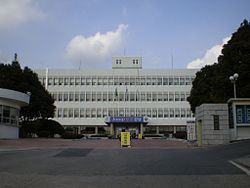
The town is Changnyeong county's administrative, business, and traffic center where most of the farm produce is bought and sold. It is nearly in the center of the county and is accessible via the Seoul-Busan expressway and national roads 5 and 24.
Changnyeong Town contains many national treasures and is situated in the middle of Changnyeong county's three major tourist attractions, Upo wetland, Bugok natural hotsprings, and Hwawang mountain.
Etymology
Changnyeong (from Korean Changnyeong, meaning "prosperous peace";from chang (Korean)창,(Hanja)昌 , meaning "prosperity", and nyeong (Korean)녕,(Hanja)寧 , meaning "peace")
Outline
Changnyeong is located in the central eastern part of Changnyeong county, with Miryang (밀양시) and Muan township (무안면) to the east, Goam township (고암면) to the north, Daeji township (대지면) and Yueo township (유어면) to the west, and Kyeseong township (계성면) to the south. The eastern part of the town is mountainous beginning with Mount Hwawang. The western part of the town has a hot and humid climate and is made up of rolling plains which are used for cultivating rice, onions, garlic, and peppers.
History
Timeline of Changnyeong history:
Administrative divisions
Educational Institutions
Cultural assets
Attractions
Hwawang Mountain, Changnyeong Downtown Market, Changnyeong History Museum, Seokbinggo