
Prominence 215 m (705 ft) OS grid TQ139120 Elevation 242 m | Topo map OS Landranger 198 Listing Marilyn | |
 | ||
Similar Cissbury Ring, Bramber Castle, Ditchling Beacon, South Downs National, Butser Hill | ||
Chanctonbury Ring is a hill fort based ring of trees atop Chanctonbury Hill on the South Downs, on the border of the civil parishes of Washington and Wiston in the English county of West Sussex. A ridgeway, now part of the South Downs Way, runs along the hill. Bertrand Russell once remarked that "any view that includes Chanctonbury Ring is a good view".
Contents
- Map of Chanctonbury Ring Pulborough UK
- Height
- Access
- Dew pond
- Hill fort
- Roman temples
- 18th century copse
- Legends
- References
Map of Chanctonbury Ring, Pulborough, UK
Height
A trig point is located about 400 metres (440 yd) west of the Ring, recorded by the Ordnance Survey as 238 metres (781 ft) above sea level. Although this was originally recorded as the top of Chanctonbury Hill and thus the Marilyn summit, recent measurements suggest that the area of the Ring is higher, about 242 metres (794 ft) above sea level.
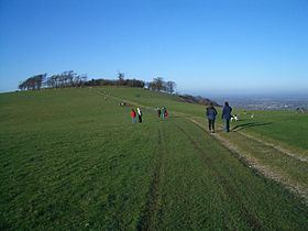
Access
There are two car parks at the base of the hill: to the north-east on Chanctonbury Ring Road off the A283 Washington Road, and to the west on Washington Bostal just off the A24 road. It is a very pleasant walk up to the top of the hill, with extensive views, particularly to the north as a result of the steep escarpment.
Dew pond
Near the trig point is Chanctonbury Dew Pond, a Site of Special Scientific Interest. Constructed about 1870, it was restored by the Sussex Society of Downsmen in 1970, and is maintained by them.
Hill fort
Chanctonbury Ring was originally a small hill fort in a commanding position looking across The Weald to the north. Pottery found and carbon dating on an animal bone suggest the fort was built in the early Iron Age, in the 6th to 5th centuries BC, but some Bronze Age pottery has also been found on the site.
Roman temples
After the abandonment of the hill fort, the ring was used by the Romans as a religious site (possibly due to similar Iron Age religious activity there). Two temples were erected, although it is not clear whether they stood at the same time or whether one succeeded the other. One Roman temple was potentially classical in form and consisted of a polygon of perhaps eleven sides. A second Romano-Celtic Temple with towered central sanctuary and outer ambulatory, certainly dated from the later Roman period.
18th century copse
The fame of the Ring, however, is due not to the hill fort but to the beech trees, which were planted in 1760 by Charles Goring within the earth bank of the fort, which is still prominent today. The trees became a famous landmark, very thickly wooded; however, the Great Storm of 1987 destroyed most of the trees and the replanted trees are only now beginning to restore the ring to its former glory.
Legends
Local legend has it that Chanctonbury Ring was created by the Devil and that he can be summoned by running around the clump of trees seven times anti-clockwise. When he appears he will offer you a bowl of soup in exchange for your soul. Frank R. Williams, writing in the Sussex Notes and Queries in 1944, said that the story derives from ancient pagan worship which would include a ritual dance ceremony followed by a sacrificial feast. The association with Chanctonbury derives from an earlier pagan site on the land.
The Ring is also rumoured to increase fertility in women who sleep underneath the trees for one night.