
Country Pakistan Tehsil Abbottabad | District Abbottabad Province Khyber Pakhtunkhwa | |
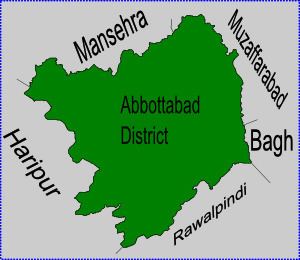 | ||
Chamad (also known as Chamhad) is one of the 51 Union Councils (subdivisions) of Abbottabad District in the Khyber Pakhtunkhwa province of Pakistan.
Contents
Map of Chamhad, Pakistan
Location
Chamad is located at 34°7'0N 73°4'60E, in the west of the district where it forms part of Abbottabad's border with Haripur District. It has an average elevation of 870 metres (2857 feet). Neighbouring settlements include Patian, Baghdara and Talhad and Sarbangala
Subdivisions
The Union Council is subdivided into the following areas: Khani Thathiara, Shadial, Chamhad, Fateh Bandi, Sarbangala, Chamak Mera, Bagh Darah, Bermgali, Bisala, Mohal, Baln Seri, Bain Noora, Bain Gojra, Bothiala, Jattal, Baghati, Thana, Kasaki Khurd, Kasaki Kalan, Daroparh and Bhoraj.
References
Chamhad Wikipedia(Text) CC BY-SA