
Founded 1912 | Date dissolved 1936 | |
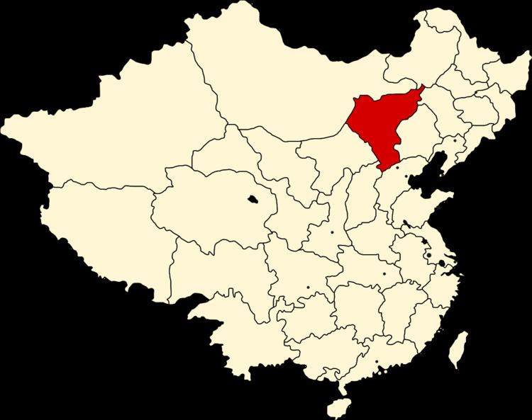 | ||
Chahar (Mongolian: ᠴᠠᠬᠠᠷ Чахар; traditional Chinese: 察哈爾; simplified Chinese: 察哈尔; pinyin: Cháhā'ěr), also known as Chaha'er, Chakhar, or Qahar, was a province of the Republic of China in existence from 1912 to 1936, mostly covering territory in what is part of eastern Inner Mongolia. It was named after the Chahar Mongolians.
Contents
Administration and history
Chahar Province is named after the Chahar, a tribal group of the Mongols who live in that area. Before the unification of the Mongol tribes under Genghis Khan, the area had seen intermittent Chinese influence over the native Mongols. After the Yuan Dynasty (1271–1368), the area was only intermittently controlled by China. The Chahar had become the personal appanage of the Khagans of Mongolia since the reign of Batumongke Dayan Khan (r. 1479–1517). By the Qing Empire (1644–1912), Chahar was not yet a Chinese province, but a "Special Region" (Zhangyuan (張垣特區)), although Yao Xiguang (姚錫光) proposed making Chahar a province as early as 1908.
In 1913, the second year of the Republic of China, Chahar Special Administrative Region was created as a subdivision of Zhili (直隸) Province, containing 6 Banners and 11 counties:
In 1928, it became a province. The last five counties on the above list (starting from Xinghe) were partitioned to Suiyuan province. And ten counties were included from Xuanhua Subprefecture (宣化府), Koubei Circuit (口北道), Hebei Province:
All banners belong to the Shilingol Alliance (ᠰᠢᠯᠢ ᠶᠢᠨᠭᠣᠤᠯ, 锡林郭勒盟).
From 1937 to 1945, it was occupied by Japan and made a part of Mengjiang, a Japanese-controlled region led by Mongol Prince Demchugdongrub of the Shilingol Alliance. The Chahar People's Anti-Japanese Army Alliance (察哈爾民眾抗日同盟軍) was established in Kalgan on May 26, 1933 by Feng Yuxiang (馮玉祥) and Ji Hongchang (吉鴻昌).
1948-1952
In 1952, six years after becoming communist, the province was abolished and divided into parts of Inner Mongolia, Beijing Municipality and Hebei.
Geography
Chahar Province was divided north-south by the Great Wall, with North Chahar being the larger in area and South Chahar, with the capital, Zhangjiakou, being far larger in population. It had an area of 278.957 km². In North Chahar most of the land was part of the northeastern extension of the Gobi Desert.