
Intercommunality Bénévent-Grand-Bourg Area 43.2 km² Population 356 (1999) | Canton Bénévent-l'Abbaye Time zone CET (UTC+1) Local time Friday 5:16 PM | |
 | ||
Weather 14°C, Wind S at 27 km/h, 58% Humidity | ||
Châtelus-le-Marcheix is a commune in the Creuse department in the Nouvelle-Aquitaine region in central France.
Contents
Map of 23430 Ch%C3%A2telus-le-Marcheix, France
Geography
A village of farming, forestry, lakes and streams situated some 22 miles (35 km) southwest of Guéret by the banks of the Taurion river and at the junction of the D5, D8 and the D48 roads. The village lies on the pilgrimage path of the Way of St. James.
Personalities
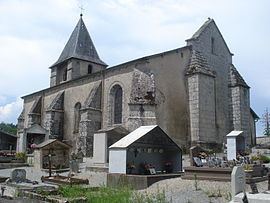
Sights
References
Châtelus-le-Marcheix Wikipedia(Text) CC BY-SA