
Topo map USGS Youngsville Prominence 415 m | Elevation 3,006 m | |
 | ||
Similar Chicoma Mountain, Redondo Peak, Valles Caldera, Truchas Peak, Wheeler Peak | ||
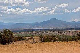
Cerro Pedernal, locally known as just "Pedernal", is a narrow mesa in northern New Mexico. The name is Spanish for "flint hill". The mesa lies on the north flank of the Jemez Mountains, south of Abiquiu Lake, in the Coyote Ranger District of the Santa Fe National Forest. Its caprock was produced in the Jemez Volcanic Field. Its highest point is 9,862 feet (3,006 meters).
Map of Cerro Pedernal, New Mexico 87516, USA
Pedernal is the source of a chert used by the prehistoric Gallina people. Its cliffs are popular with rock climbers. Georgia O'Keeffe made many paintings of it, and her ashes were scattered on its top.
References
Cerro Pedernal Wikipedia(Text) CC BY-SA