
Primary outflows Rio Chama Max. length 12 mi (20 km) Surface elevation 1,860 m Length 20 km Inflow source Chama River | Primary inflows Surface area 5,200 acres (2,100 ha) Area 21.04 km² Outflow location Chama River | |
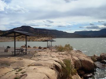 | ||
Abiquiu Lake is a reservoir located in Rio Arriba County, in northern New Mexico in the southwestern United States. Water of the Rio Chama is impounded by the earth-filled Abiquiu Dam, 1,800 feet (550 m) long and 340 feet (104 m) high, completed in 1963 and raised in 1986. The 5,200-acre (21 km2) lake is over 12 miles (20 km) long, and lies at elevations of 6,100–6,220 feet (1,859–1,896 m).
Map of Abiquiu Reservoir, New Mexico 87017, USA
The shoreline area near the dam is a recreation area managed by the US Army Corps of Engineers (USACE). Available activities include camping, picnicing, hiking, swimming, boating, and fishing.
References
Abiquiu Lake Wikipedia(Text) CC BY-SA