
 | ||
Mountains Volcán de Fuego, Masaya Volcano, Tiger Island, Isla Zacate Grande Similar Pacaya, Volcán de Fuego, Volcán Tacaná, Masaya Volcano, Tecuamburro | ||
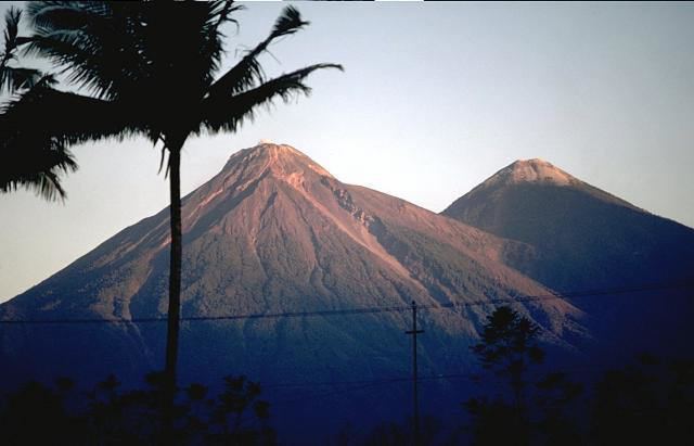
The Central American Volcanic Arc (often abbreviated to CAVA) is a chain of volcanoes which extends parallel to the Pacific coast line of the Central American Isthmus, from Guatemala, El Salvador, Honduras, Nicaragua, Costa Rica, and down to northern Panama. This volcanic arc, which has a length of 1,500 kilometres (930 mi), is formed by an active subduction zone along the western boundary of the Caribbean Plate.
The Central American Volcanic Arc includes hundreds of volcanic formations, ranging from major stratovolcanoes, to lava domes and cinder cones. Some of these have produced large explosive eruptions, like the colossal VEI 6 eruption of the Santa Maria volcano in 1902. Central America's highest volcanoes are found in Guatemala and include the Tajumulco and Volcán Tacaná, both above 4,000 meters. Several volcanoes in Central America are currently active, including Arenal, Turrialba, Irazú, Poás in Costa Rica; Cerro Negro, San Cristóbal, Concepción in Nicaragua; Chaparrastique or San Miguel, Ilamatepec or Santa Ana, Izalco in El Salvador; Santa Maria/Santiaguito, Pacaya, Fuego in Guatemala.