
Last eruption 960 BCE ± 75 years Parent range Sierra Madre de Chiapas | Elevation 1,845 m | |
 | ||
Similar Moyuta, Volcán Jumaytepeque, Tahual, Cuilapa‑Barbarena, Ixtepeque | ||
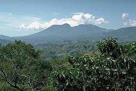
Tecuamburro is a stratovolcano in southern Guatemala, roughly 50 kilometres south east of Guatemala City. The Tecuamburro is an andesitic stratovolcano which formed approximately 38,000 years ago inside a horseshoe-shaped caldera formed by a structural failure in a second, 100,000-year-old stratovolcano, known as Miraflores. At the top of the Tecuamburro is an acidic crater lake around which many hot springs, fumaroles, and boiling mudpots are found.
Map of Volcan Tecuamburro, Guatemala
References
Tecuamburro Wikipedia(Text) CC BY-SA