
Country Canada Time zone EST (UTC−5) Website www.cayamant.ca Population 875 (2011) Province Québec | Constituted October 10, 1906 Postal code(s) J0X 1Y0 Area 412.7 km² Local time Monday 10:12 PM Area code 819 | |
 | ||
Weather -3°C, Wind SE at 8 km/h, 100% Humidity RCMs Outaouais, La Vallée-de-la-Gatineau Regional County Municipality | ||
Cayamant is a municipality in La Vallée-de-la-Gatineau Regional County Municipality, Quebec, Canada. The village of Lac-Cayamant is located at the north end of Lake Cayamant, west of Gracefield.
Contents
Map of Cayamant, QC, Canada
It was formerly known as the Township Municipality of Dorion, named after Antoine-Aimé Dorion (1818-1891). It was renamed to the Municipality of Cayamant at the end of 1988, due to many problems created by having the identical name to that of the city of Dorion (which merged with neighbouring Vaudreuil in 1994). The new name refers to the largest lake in its territory, Lake Cayamant. The Algonquin term Kakgama, Kandikagamaw, or Kandikagama means "porcupine". Alternatively, it may come from Kantuagama, which means lake with a large bay.
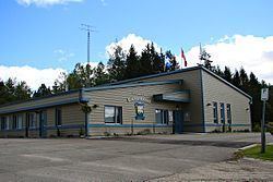
The village has a primary school, a church, and some convenience stores, restaurants and some basic commerce. Most of the population lives near the lake. The most populated street is "Rue Principale" (Main Street).
History
Between 1890 and 1900, a few settlers moved to the shores of Cayamant Lake, becoming home to a flood of French Canadians who were heading to the west of the province in search of farmland.
In 1902, the "Lake Cayamont" post office opened (renamed in 1943 to Lake Cayamant). The Township Municipality of Dorion was formed on October 10, 1906. The first municipal council was elected on October 17, 1906.
In 1918, the parish of Saint-Roch-du-Lac Cayamant was established. In 1988, Dorion was renamed to Cayamant.
Demographics
Population trend:
Private dwellings (occupied by usual residents): 422
Languages: