
- location near Red Butte Mouth Little River | - elevation 4,019 ft (1,225 m) - elevation 889 ft (271 m) Country United States of America | |
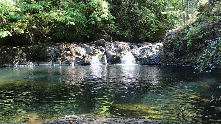 | ||
Explore oregon recreation cavitt creek falls recreation site
Cavitt Creek is a tributary of the Little River in Douglas County in the U.S. state of Oregon. From its source near Red Butte, the creek flows generally west then north through the Umpqua National Forest of the Cascade Range before entering the river about 1.5 miles (2.4 km) upstream of the rural community of Peel and 7 miles (11 km) above the Little River's mouth on the North Umpqua River.
Contents
- Explore oregon recreation cavitt creek falls recreation site
- Map of Cavitt Creek Oregon USA
- Cavitt creek falls and north bank habitat
- Bridge
- Tributaries
- References
Map of Cavitt Creek, Oregon, USA
Cavitt Creek Falls Recreation Site is about 3 miles (5 km) upstream of the confluence along Cavitt Creek Road. Managed by the Bureau of Land Management, the forested site features a 6-foot (1.8 m) waterfall above a swimming hole. Amenities include campsites, water spigots, parking, and restrooms, as well as proximity to fishing spots and hiking trails. The park is open from May 22 to September 26.
Cavitt creek falls and north bank habitat
Bridge
Cavitt Creek Bridge carries Cavitt Creek Road over the Little River downstream of the confluence of the creek and the river. The road crosses Jim Creek, another Little River tributary, before reaching the bridge.
Tributaries
Named tributaries of Cavitt Creek from source to mouth are Withrow, Cultus, Liveoak, Tuttle, and Springer creeks. Further downstream come Mill, White Rock, Copperhead, Buck Peak, Buckshot, McKay, and Evans creeks.