
Location Matauri BayWhangaroa | Area 3.4 km² | |
 | ||
Cavalli islands diving
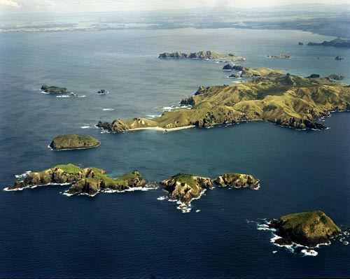
The Cavalli Islands are a small group of islands near Whangaroa on Northland's East Coast in northern New Zealand. They lie 3 kilometres (1.9 mi) to the east of Matauri Bay on the mainland.
Contents
- Cavalli islands diving
- Map of Cavalli Islands New Zealand
- Kayak fishing cavalli islands nz with viking kayaks
- References
Map of Cavalli Islands, New Zealand
The group consists of the island of Motukawanui (area 3.4 km2 or 1.31 sq mi) and the smaller islets of Motutapere, Panaki, Nukutaunga, Motuharakeke, Haraweka, and Motukawaiti Islands. The main island is used as a nature reserve, and some of the smaller islands are privately owned.
The Cavallis were so named by Captain James Cook on 27 December 1769 during his first voyage of discovery. In his journal he recorded that some Māori "sold us some fish--Cavallys as they are called--which occasioned my giving the Islands the same name". Cook probably meant trevally which is abundant near the islands, because the Māori word for that fish is araara.
On 2 December 1987, the hulk of the bombed Greenpeace vessel Rainbow Warrior was scuttled between Matauri Bay and the Cavalli Islands, to serve as a dive wreck and fish sanctuary. The move was seen as a fitting end for the vessel.