
Traditional Chinese 銅鑼灣避風塘 Hanyu Pinyin | Simplified Chinese 铜锣湾避风塘 | |
 | ||
Jyutping Tung Lo Waan bei fung tong | ||
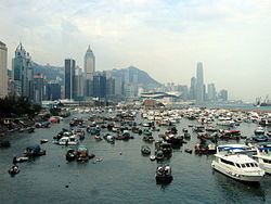
A walk in the twilght at causeway bay typhoon shelterlarge
Causeway Bay Typhoon Shelter is a typhoon shelter located in Causeway Bay, Hong Kong, between the Hong Kong Island entrance of Cross Harbour Tunnel on Kellett Island and Island Eastern Corridor. It was the first typhoon shelter in Hong Kong. At the present location it is about 14 hectares (35 acres) in area, although it is currently largely filled in, as part of road development works.
Contents
- A walk in the twilght at causeway bay typhoon shelterlarge
- Map of Causeway Bay Typhoon Shelter Hong Kong
- History
- Present status
- Environmental concerns
- Surrounding roads
- Notable places nearby
- References
Map of Causeway Bay Typhoon Shelter, Hong Kong
History
The original typhoon shelter was built after the 1874 typhoon, at the present location of Victoria Park, to provide shelter for fishing boats during storms. It was completed in 1883 with a breakwater only 427 metres (1,400 feet) long. The cost was HK$96,500.
In December 1903 a Legislative Council member, Gershom Stewart, suggested that the typhoon shelter be expanded. The motion was passed but expansion works could not be carried out due to lack of capital. The Legislative Council and the Hong Kong Chamber of Commerce questioned the Hong Kong Government on the expansion in 1904 and 1906, but the Government did not give any response.
On 18 September 1906, a typhoon struck Hong Kong, destroying 3,653 boats and killing 15,000 people, most of them fishermen. In March 1908 the Government finally carried out expansion works on the typhoon shelter, deepening it by 3 metres (9 feet) and expanded it to 30 hectares (75 acres).
In 1953 the typhoon shelter was moved northwards to its present site and the original typhoon shelter was reclaimed to provide land for Victoria Park. The new typhoon shelter had a size of 26 hectares (65 acres). However, reclamation projects which started in the typhoon shelter during the late 1960s to construct the Cross Harbour Tunnel decreased the size of the typhoon shelter.
Present status
Much of the shelter has been temporarily reclaimed as a working area for construction of the Central-Wan Chai Bypass (the working for Route 4 Reengineering), an underground road, under works that are part of the Wan Chai Phase II project of the Central and Wan Chai Reclamation, begun in 2009 and scheduled for completion in 2017.
Environmental concerns
A 2005 Government report singled out the Causeway Bay Typhoon Shelter as having "exceptionally high levels" of tributyltin, exceeding 1000 times the baseline concentration measured in the East Lamma Channel.
Surrounding roads
To the west:
To the south:
To the east:
Notable places nearby
Central Wan Chai Bypass