
River mouth Orinoco14 m (46 ft) Length 723 km | Discharge 3,000 m³/s | |
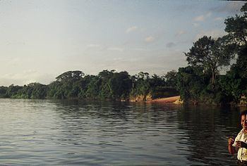 | ||
The Caura, is a tributary of the Orinoco River, located in Bolívar State in Venezuela. Its flow is the second after the Caroni River among the affluents of the Orinoco River, with almost 3,000 cubic metres per second (110,000 cu ft/s). The river is inhabited by both the Ye'kuana and Sanema indigenous groups.
Contents
Map of Rio Caura, Bol%C3%ADvar, Venezuela
Basin
The Caura River is about 723 kilometres (449 mi) long. Its major tributary is the Erebato. Both rivers emerge from the Jaua-Sarisariñama Plateau, more than 2,000 metres (6,600 ft) above sea level). The Caura is navigable up to Para Falls (Salto Pará), an impressive waterfall formed by two branches of the river with an island in the middle 6.310521°N 64.523735°W / 6.310521; -64.523735 Both branches have some rapids and join in one of the most remarkable waterfalls in the Orinoco basin, not because of its height, but because of the impressive flow of water. The Caura is a Blackwater river, like the Caroní, the Ventuari River and the upper Orinoco. The Caura is 1,500 metres (4,900 ft) wide at Musinacio (Musiú Ignacio ), the point where it joins the Orinoco, 5.6 kilometres (3.5 mi) wide at this point.
Microclimate
Satellite images in the Intertropical Zone show an interesting lack of clouds above the biggest rivers, such as the Caura and Orinoco, and also in the Amazon river7.436007°N 64.798737°W / 7.436007; -64.798737. We need to take into account two facts: