
Country United States ZIP codes 21228, 21229, 21250 Elevation 146 m Population 41,567 (2010) | Time zone Eastern (EST) (UTC-5) FIPS code 24-14125 Area 36.3 km² | |
 | ||
Neighborhoods Academy Heights, Oella, Westchester | ||
Catonsville real estate for sale 112 osborne avenue catonsville maryland 21228
Catonsville is a census-designated place (CDP) in Baltimore County, Maryland, United States. The population was 41,567 at the 2010 census. The community lies to the west of Baltimore along the city's border. Catonsville is dominated economically and demographically by the presence of the University of Maryland, Baltimore County (UMBC), a major public research university with close to 14,000 students.
Contents
- Catonsville real estate for sale 112 osborne avenue catonsville maryland 21228
- Map of Catonsville MD USA
- History
- Geography
- Neighborhoods
- Demographics
- Public schools
- Private schools
- Higher education
- US National Register of Historic Places
- Independence Day celebration
- Natives and residents of note
- Arts and media
- Music
- Sports
- Professional sports teams
- References
Map of Catonsville, MD, USA
History
Europeans were the second group to settle the area now known as Catonsville. It is generally believed by historians that native tribes, known as the Piscataway, established villages here before the European colonists arrived. This tribe occupied the land between the Potomac River and Chesapeake Bay and up the Patapsco River. Catonsville was located along the Piscataway Trail. The colonists and the tribes got along until the mid-17th century, when the English government ended the practices of Catholic missionaries in the area. It is believed that the tribes were driven from their villages and some were hunted by slave catchers. As happened in many areas of early colonial America, diseases unknown to the tribes were spread by the colonists. Eventually, the tribes moved north under the protection of the Iroquois.
With most of the natives scattered, the colonists expanded across Maryland. Present-day Catonsville was settled in the 18th century. In the early 19th century, a county road along the Patapsco River—named the Frederick Turnpike, later designated Route 144—was opened by the Ellicott family to serve traffic between their flour mill, Ellicott Mills, and Baltimore. Catonsville as we know it today was settled along this route by Richard Caton, under the authority of his father-in-law Charles Carroll, a signer of the Declaration of Independence. Travelers along "the turnpike" (as it was then known) rested and conducted business in the area, causing Catonsville to grow.
The large Victorian and Colonial homes located in Catonsville were built by wealthy Baltimoreans. Originally, these communities were used as summer residences to escape the heat in Baltimore. Eventually, as in many communities with the introduction of the automobile and electric trolley, families began to reside in Catonsville year round. Baltimore attempted over the years to annex Catonsville, the last attempt in 1918, but all attempts were rebuffed. The community remains an unincorporated town in Baltimore County. It is home to Spring Grove Hospital Center, the nation's second oldest continuously operating psychiatric hospital.
Samuel Clemens (Mark Twain) made his last public appearance on June 9, 1909, at the commencement ceremony of St. Timothy's School for Girls in Catonsville, to fulfill a promise he made to a young girl he had met on the steamer Minnehaha in 1907.
Catonsville was briefly made quite famous during the 1968 protest by the "Catonsville Nine", during which draft records were burned by Catholic anti-war activists.
In 2002, the Maryland legislature issued a proclamation declaring Catonsville to be "Music City, Maryland", because of the concentration of musical retail stores, venues and educational facilities in the area.
In 2007 Money magazine ranked Catonsville the 49th best place to live in the USA, third best in Maryland and Virginia.
Geography
Catonsville is located at 39°16′26″N 76°44′17″W (39.273756, −76.738012). According to the United States Census Bureau, the CDP has a total area of 14.0 square miles (36 km2), all of it land.
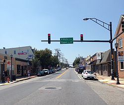
It is centered along Frederick Road (Maryland Route 144), formerly the main road from Baltimore leading to points west. Johnnycake Road and Academy Road form the northern and northeastern borders of Catonsville. Catonsville is bordered by Woodlawn to the north, Baltimore to the east, by Arbutus to the southeast, by Ilchester to the southwest, and by Ellicott City to the west.
In addition to Frederick Road (Exit 13), Interstate 695 (the Baltimore Beltway) services Wilkens Avenue (Maryland Route 372), Edmondson Avenue and the Baltimore National Pike (U.S. Route 40) via Exits 12, 14 and 15, respectively, with the latter two thoroughfares later converging in Baltimore City to the east. The main north-south roads in the area are Rolling Road (which is also Maryland Route 166 south of Frederick Road), Ingleside Avenue and Bloomsbury Avenue.
Catonsville is a terminus of the Trolley Line Number 9 Trail and the Short Line Railroad Trail.
Neighborhoods
Demographics
In 2010 Catonsville had a population of 41,567. The ethnic and racial composition of the population was 73.4% non-Hispanic white, 14.3% non-Hispanic black, 0.3% Native American, 6.3% Asian, 0.1% Pacific Islander, 0.2% non-Hispanic from some other race, 2.4% from two or more races and 3.4% Hispanic or Latino from any race.
As of the census of 2000, there were 39,820 people, 15,503 households, and 9,255 families residing in the CDP. The population density was 2,843.9 people per square mile (1,098.2/km²). There were 16,054 housing units at an average density of 1,146.6 per square mile (442.7/km²). The racial makeup of the CDP was 82.28% White, 11.83% African American, 0.22% Native American, 3.61% Asian, 0.04% Pacific Islander, 0.59% from other races, and 1.43% from two or more races. Hispanic or Latino of any race were 1.87% of the population.
There were 15,503 households out of which 25.7% had children under the age of 18 living with them, 46.7% were married couples living together, 9.9% had a female householder with no husband present, and 40.3% were non-families. 33.8% of all households were made up of individuals and 17.4% had someone living alone who was 65 years of age or older. The average household size was 2.30 and the average family size was 2.98.
In the CDP, the population was spread out with 19.9% under the age of 18, 12.0% from 18 to 24, 27.2% from 25 to 44, 20.7% from 45 to 64, and 20.2% who were 65 years of age or older. The median age was 39 years. For every 100 females there were 86.0 males. For every 100 females age 18 and over, there were 81.9 males.
The median income for a household in the CDP was $53,061, and the median income for a family was $67,005. Males had a median income of $44,705 versus $33,420 for females. The per capita income for the CDP was $25,254. About 2.8% of families and 4.6% of the population were below the poverty line, including 3.3% of those under age 18 and 4.1% of those age 65 or over. The medium house value for the CDP was $141,300 in the 2000.
Public schools
Residents are zoned to schools in the Baltimore County Public Schools. Catonsville High School, Woodlawn Senior High School (center for science and pre engineering),and Western School of Technology and Environmental Science, formerly Western Vocational Technical Center, serve the area.
Private schools
Higher education
U.S. National Register of Historic Places
Independence Day celebration
Since 1947, Catonsville has celebrated Independence Day with children's games in the morning, a parade in the afternoon, and a fireworks display at night. The children's games include a decorated bike contest, lollipop scramble, ball on spoon race, leapfrog, wheelbarrow and sack races, and a water balloon toss. The parade travels down Frederick Road and is attended by over 60,000 people each year. Residents reserve prime viewing locations by placing their folding chairs along the parade route a week or two in advance of the celebration. The parade contains floats from politicians, local businesses, schools and churches along with marching bands, including Baltimore's Marching Ravens.
The fireworks display takes place on the grounds of Catonsville High School in the evening. Residents either walk to the high school or gather at other locations (such as UMBC) to watch the show.