
Elevation 525 m (1,722 ft) First ascent Maori explorers | ||
 | ||
Translation floating island (Māori) | ||
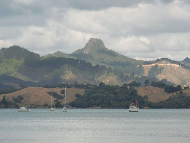
Castle Rock (Māori: Motutere) is a 525-metre-high (1,722 ft) mountain south-east of Coromandel, Waikato, New Zealand. It is used for rock climbing, with a number of high bolted routes.
Contents
Geography
Castle Rock is a prominent peak in the Coromandel Range that lies 8.4 kilometres (5.2 mi) south-east of Coromandel town, north of a 532 metres (1,745 ft) peak also called Motutere and south of an unnamed 573 metres (1,880 ft) peak in the headwaters of the westward-flowing Pukewhau Stream.
The mountain is a volcanic plug made from remnants of solidified magma, the softer surrounding rock having been eroded away.
Maori exploration
Motutere means "floating island" a name bestowed by Ruamano, a descendent of Tama-te-kapua. Māori explorers of the area tended to travel along the hill ridges, so avoiding the thick vegetation in the sheltered valleys. Once dusk came they would seek shelter in order to avoid the patupaiarehe whom they believed inhabited these hills. The summit of Motutere would be eschewed after dark for this reason.
Climbing
As of April 2014, there are 17 different ascents for rock climbers to attempt at the summit of Castle Rock. Routes include Kookmeyer, Budda Wall and the Quiet Earth Wall, with bolted climbs of up to 125 metres (410 ft) on solid rock. Access is via a forestry track that leaves the 309 Road near the Waiau Waterworks visitor centre and involves a 25–40 minute walk in. The track is also suitable for cycling and at the top ridge there are fine views of Great Mercury Island, Cuvier Island, Great Barrier Island and the Firth of Thames.