
Country United States Area code(s) 307 Population 59,628 (2013) | State Wyoming Time zone MST (UTC-7) Elevation 1,560 m Local time Sunday 8:37 PM | |
 | ||
ZIP codes 82601, 82602, 82604, 82605, 82609, 82615, 82630, 82638, 82646 Weather 9°C, Wind S at 27 km/h, 39% Humidity | ||
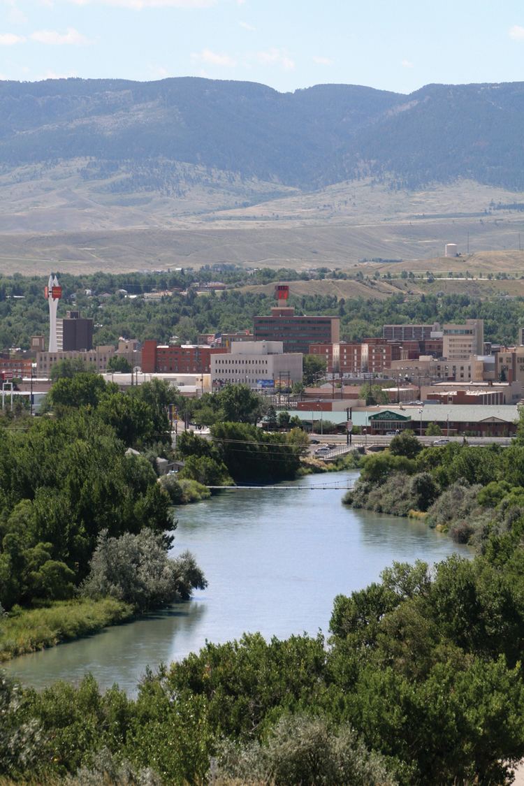
Casper (Lakota: Pahášaša Otȟúŋwahe; "Red Hill City") is a city in and the county seat of Natrona County, Wyoming, United States. Casper is the second-largest city in Wyoming, according to the 2010 census, with a population of 55,316. Only Cheyenne, the state capital, is larger. Casper is nicknamed "The Oil City" and has a long history of oil boomtown and cowboy culture, dating back to the development of the nearby Salt Creek Oil Field. In 2010, Casper was named the highest-ranked family-friendly small city in the West, and ranked eighth overall in the nation in Forbes magazine's list of "the best small cities to raise a family".
Contents
- Map of Casper WY USA
- 02 23 2017 casper wyoming blizzard conditions slide outs
- History
- Geography and climate
- 2010 census
- 2000 census
- Economy
- Education
- Media
- Sports
- Museums and historical sites
- Performing arts and music
- Highways
- Airports
- Public transit
- Scheduled bus service
- Notable people
- References
Map of Casper, WY, USA
Casper is located in east-central Wyoming at the foot of Casper Mountain, the north end of the Laramie Mountain Range, along the North Platte River.
02 23 2017 casper wyoming blizzard conditions slide outs
History
The city was established east of the former site of Fort Caspar, which was built during the mid-19th century mass migration of land seekers along the Oregon, California and Mormon trails. The area was the location of several ferries that offered passage across the North Platte River in the early 1840s. In 1859, Louis Guinard built a bridge and trading post near the original ferry locations.
The government soon posted a military garrison nearby to protect telegraph and mail service. It was under the command of Lieutenant Colonel William O. Collins. American Indian attacks increased after the Sand Creek Massacre in Colorado in 1864, bringing more troops to the post, which was by now called Platte Bridge Station. In July 1865, Lieutenant Caspar Collins (the son of Colonel Collins) was killed near the post by a group of Indian warriors. Three months later the garrison was renamed Fort Caspar after Lieutenant Collins. In 1867, the troops were ordered to abandon Fort Caspar in favor of Fort Fetterman downstream on the North Platte along the Bozeman Trail.
The town of Casper itself was founded well after the fort had been closed. The city was founded by developers as an anticipated stopping point during the expansion of the Wyoming Central Railway; it was an early commercial rival to Bessemer and Douglas, Wyoming. The lack of a railhead doomed Bessemer in favor of Casper. Douglas, also a railhead, survives to the present day. The presence of a railhead made Casper the starting off point for the "invaders" in the Johnson County War. The special chartered train carrying the men up from Texas stopped at Casper. The reason why the town is named Casper, instead of Caspar honoring the memory of Fort Caspar and Lt. Caspar Collins, is due to a typo that occurred when the town's name was officially registered.
Geography and climate
Interstate 25, which approaches Casper from the north and east, is the main avenue of transportation to and from the city. The towns immediately adjacent to Casper are Mills, Evansville, and Bar Nunn. Unincorporated areas include Allendale, Dempsey Acres, Red Buttes, Indian Springs, and several others.
Casper is located at 42°50′5″N 106°19′30″W (42.834665, −106.325062). It sits at an average elevation of about 5,200 feet (1,600 m) (just slightly lower than Denver).
According to the United States Census Bureau, the city has a total area of 27.24 square miles (70.55 km2), of which, 26.90 square miles (69.67 km2) is land and 0.34 square miles (0.88 km2) is water.
Casper, as with most of the rest of Wyoming, has a semi-arid climate (Köppen climate classification BSk), with long, cold, but dry winters, hot but generally dry summers, mild springs, and short and crisp autumns. Highs range from 32 °F (0 °C) in January to 88 °F (31.1 °C) in July and August. Temperatures typically plummet during summer nights, with an average diurnal temperature variation approaching 35 °F (19.4 °C). Snow can fall heavily during the winter months, being the greatest in April, and usually falls in May and October, but rarely September. Precipitation is greatest in spring and early summer, but even then it is not high. Highs reach 90 °F (32.2 °C) on 31 days per year and fail to surpass freezing on 46. Lows drop to 0 °F (−17.8 °C) on 18 nights per winter.
2010 census
As of the census of 2010, there were 55,316 people, 22,794 households, and 14,237 families residing in the city. The population density was 2,056.4 inhabitants per square mile (794.0/km2). There were 24,536 housing units at an average density of 912.1 per square mile (352.2/km2). The racial makeup of the city was 92.3% White, 1.0% African American, 0.9% Native American, 0.8% Asian, 2.3% from other races, and 2.6% from two or more races. Hispanic or Latino of any race were 7.4% of the population.
There were 22,794 households of which 31.5% had children under the age of 18 living with them, 46.1% were married couples living together, 11.2% had a female householder with no husband present, 5.2% had a male householder with no wife present, and 37.5% were non-families. 30.3% of all households were made up of individuals and 10.1% had someone living alone who was 65 years of age or older. The average household size was 2.38 and the average family size was 2.95.
The median age in the city was 36 years. 23.9% of residents were under the age of 18; 10.2% were between the ages of 18 and 24; 26.7% were from 25 to 44; 26.4% were from 45 to 64; and 12.9% were 65 years of age or older. The gender makeup of the city was 49.7% male and 50.3% female.
2000 census
As of the census of 2000, there were 49,644 people, 20,343 households, and 13,141 families residing in the city. The population density was 2,073.2 people per square mile (800.3/km²). There were 21,872 housing units at an average density of 913.4 per square mile (352.6/km²). The racial makeup of the city was 94.03% White, 0.86% Black, 1.00% Native American, 0.49% Asian, 0.02% Pacific Islander, 2.04% from other races, and 1.56% from two or more races. 5.35% of the population were Hispanic or Latino of any race.
There were 20,343 households out of which 31.8% had children under the age of 18 living with them, 49.6% were married couples living together, 11.1% had a female householder with no husband present, and 35.4% were non-families. 29.1% of all households were made up of individuals and 10.2% had someone living alone who was 65 years of age or older. The average household size was 2.38 and the average family size was 2.94.
In the city, the population was spread out with 25.9% under the age of 18, 10.5% from 18 to 24, 27.7% from 25 to 44, 22.3% from 45 to 64, and 13.6% who were 65 years of age or older. The median age was 36 years. For every 100 females there were 95.0 males. For every 100 females age 18 and over, there were 91.6 males.
The median income for a household in the city was $36,567, and the median income for a family was $46,267. Males had a median income of $34,905 versus $21,810 for females. The per capita income for the city was $19,409. About 8.5% of families and 11.4% of the population were below the poverty line, including 15.4% of those under age 18 and 7.3% of those age 65 or over.
Economy
Although relatively small by national standards, Casper is a regional center of banking and commerce.
Since the discovery of crude oil in the region during the 1890s, Casper became the regional petroleum industry center. Oil has figured prominently in its history from nearly the outset. Oil was first discovered in the famous Salt Creek Oil Field in 1889, approximately 40 miles (64 km) north of Casper; the first refinery in Casper was built in 1895. The city has featured a refinery ever since, although various refineries have been built and closed over the years. As recently as the early 1980s, the city was near or home to three refineries. The surviving one, operated by Sinclair Oil Corporation, is located nearby in Evansville, Wyoming. Development of Wyoming coal and uranium fields in recent decades has helped Casper continue its role as a center in the energy industry.
Education
Casper is home to Casper College, a community college that offers bachelor's degrees in sixteen areas of study from the University of Wyoming through their UW/CC Center.
Public education in the city of Casper is provided by Natrona County School District #1. The district operates sixteen elementary schools, five middle schools, and three high schools in Casper. The high schools include Kelly Walsh, Natrona County, and Roosevelt High Schools, There is also a program being added to Natrona County School District called CAPS, it will serve as more space and classrooms for juniors and seniors at any of the 3 Highschools.
Media
Casper is served by two print newspapers, the Casper Star-Tribune, a daily, and the Casper Journal, published weekly. Casper is also home to WyoFile, an online publication focusing on state issues.
Sports
UFC 6 took place at the Casper Events Center in 1995
Casper hosted the AIFA Championship Bowl III at the Casper Events Center on July 26, 2009.
Casper has hosted the College National Finals Rodeo since 2001.
Sports teams based in Casper include:
Museums and historical sites
Casper is home to a number of museums and historical sites:
Performing arts and music
Casper has three locations offering theatre: The Gertrude Krampert Theatre at Casper College, Stage III Community Theatre, and the Casper Events Center where an annual series of touring Broadway shows, Broadway in Casper, can be seen.
Casper is home to the Troopers, a drum and bugle corps in Drum Corps International, and the Wyoming Symphony Orchestra. During the summer months, Casper's City Band performs free concerts Thursday evenings at Washington Park, weather permitting.
Highways
Interstate Highways:
US Routes:
Wyoming State Highways:
Airports
The city has scheduled air service at Casper/Natrona County International Airport, a former army air base built during World War II. The current airport, having been built for bombers, has large runways and replaced a prior regional airport north of Casper which later became Bar Nunn. The airport is located west of the city just off of US highway 20/26. In July 2004, the airport facilities were renovated. Passenger service at the airport is offered by United Express (SkyWest Airlines), Delta Connection (SkyWest Airlines), and Allegiant Airlines. FedEx Express and FedEx Feeder provide cargo airline service to the airport.
Public transit
Public transit in the Casper area is provided by the Casper Area Transportation Coalition. They offer fixed route service called The Bus and an on request service called CATC.
Scheduled bus service
Scheduled bus service once offered by Power River Bus Lines is now offered by Black Hills Stage Lines.