
 | ||
Antiquity
Babylon in Southwest Asia is at the center of the very earliest world maps, beginning with the Babylonian world map in the 6th century BC; it is a clay tablet 'localized' world map of Babylon, rivers, encircling ocean, and terrain, surrounded by 'islands' in a 7-star format. In classical Greek geography, "Asia" is one of three major landmasses, besides Europe and Libya. Asia is given higher resolution in Hellenistic geography, in particular on Ptolemy world map. Cartography of India begins with early charts for navigation and constructional plans for buildings. Chinese geography from the 2nd century BC (Han dynasty) becomes aware of Turkestan, where Hellenistic Greek and Han Chinese spheres of influence overlap.
Contents
Middle Ages
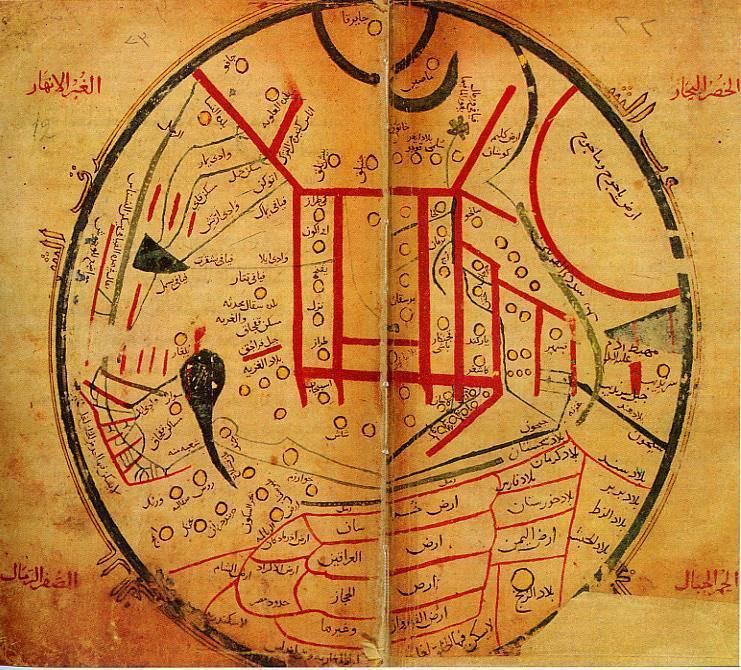
In medieval T and O maps, Asia makes for half the world's landmass, with Africa and Europe accounting for a quarter each. With the High Middle Ages, Southwest and Central Asia receive better resolution in Muslim geography, and the 11th century map by Mahmud al-Kashgari is the first world map drawn from a Central Asian point of view. In the same period, European explorers of the Silk road like William Rubruck and Marco Polo increase geographical knowledge of Asia in the west, in particular establishing that the Caspian Sea is not connected to the northern ocean.
Chinese exploration by medieval times extends Chinese geographical knowledge to the Indian ocean, the Arabian peninsula and East Africa as well as Southeast Asia.
Age of exploration
European maps of Asia become much more detailed from the 15th century, the 1459 Fra Mauro map showing a reasonable complete picture, including correctly placed Korea and Japan.
Modern maps
The modern map making techniques in India, like other parts of the world, employ digitization, photographic surveys and printing. Satellite imageries, aerial photographs and video surveying techniques are also used.