
 | ||
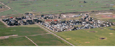
Carseland is a hamlet in Alberta, Canada within Wheatland County. It is located on Highway 24, approximately 23 km (14 mi) south of Cheadle, Alberta and 26 km (16 mi) south of Strathmore.
Contents
Map of Carseland, AB, Canada
It is within Alberta Census Division No. 5.
History
The advent of the cattlemen in the late 1800s to the Bow River country west of the Blackfoot Indian Reserve brought men like: Major General Thomas Bland Strange (1881), Charlie Hawks, Colonel Arthur Goldfinch, Felix McHugh (1886) and Colonel Arthur Wyndham (1887) to the Carseland area.
When the Military Colonization Company, which Strange had founded ceased to exist, the Canadian Pacific Railway (CPR) permitted free grazing on their 3,000,000 acres (12,000 km2) on the north side of the Bow and it attracted many new settlers to the area.
The Addemans, Moffats and McGregors purchased the Horsetrack from the Goldfinchs and started the Horsetrack Cattle Company in 1901. Others such as Groves, Moorhouse, Brown, McHughes, McKinnon and Newbolts soon followed.
When the open range came to an end most of the areas cattlemen became the first grain farmers of the district.
In 1903, the CPR brought irrigation to its large land acquisitions in the Carseland area.
As the land prospered and more product was being shipped by rail to market, the CPR began construction of the Gleichen/Shepard cut-off in 1913. These rails carried troops to the First World War in 1914.
Due to its proximity to the river crossing and railway, Carseland grew rapidly into a prosperous community during the 1920s through 1940s. It boasted six grain elevators, a railway station, school, general store, barber shop and pool-room, post office, restaurant, garage and Ford car dealer, well house, lumber yard, hardware store, meat market, bank, stock yards, two churches, hotel and community centre. Only three original buildings still standing on Railway Avenue are the hotel, the post office was formerly the Carseland Meat Market owned by the Bonitz family (and is now in the one strip mall) and the former hardware store - all of which were built in 1916.
Demographics
As a designated place in the 2016 Census of Population conducted by Statistics Canada, Carseland recorded a population of 525 living in 215 of its 228 total private dwellings, a change of 2999240000000000000♠−7.6% from its 2011 population of 568. With a land area of 0.57 km2 (0.22 sq mi), it had a population density of 921.1/km2 (2,385.5/sq mi) in 2016.
As a designated place in the 2011 Census, Carseland had a population of 568 living in 208 of its 223 total dwellings, a -3.4% change from its 2006 population of 588. With a land area of 0.64 km2 (0.25 sq mi), it had a population density of 888/km2 (2,299/sq mi) in 2011.
Economy
Carseland's main employers include Agrium, Orica and Stella-Jones.