
Local time Saturday 9:35 PM | Province Ulster | |
 | ||
Weather 4°C, Wind SW at 8 km/h, 97% Humidity | ||
Carrickmore (from Irish: an Charraig Mhór, meaning "the big rock") is a town in County Tyrone, Northern Ireland. It lies in the heart of the county on a raised site colloquially called "The Rock"; between Cookstown, Dungannon and Omagh. It is situated in the historic barony of Omagh East and the civil parish of Termonmaguirk. It had a population of 612 in the 2001 Census. In the 2011 Census 2,330 people lived in the Termon Ward, which covers the Carrickmore and Creggan areas.
Contents
- Map of Carrickmore Omagh UK
- History
- Places of interest
- Transport
- Geography
- Sport
- Employment
- 2001 Census
- Carrickmore Townland
- References
Map of Carrickmore, Omagh, UK
History
The area is steeped in history and there are many tales and legends connected with St. Colmcille and the town, including the saint's well, chair and bed which are still in existence. A wide range of historic monuments can be found in the Carrickmore area, including cairns, stone circles, standing stones and raths.
The Dean Brian Maguirc College, a second level education school, is named after Dean Brian McGurk who was Vicar-General to St Oliver Plunkett during the Penal Times and died in Armagh Gaol aged 91.
Carrickmore holds the annual Tyrone County Commemoration of the 1916 Easter Rising and a remembrance ceremony for all republicans killed in The Troubles since 1969.
Two historical figures from the Clan na Gael and Irish Republican Brotherhood hailed from the Carrickmore area: Joseph McGarrity and Patrick McCartan, who helped fund the 1916 Easter Rising.
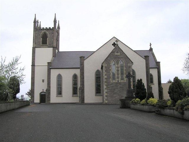
Irish Civil rights campaigner, activist and author, the Rev. Denis Faul, became the Catholic parish Priest of Termonmaguirc (also known as Termonmaguirk and Termonmcgurk) in 1998. Msgr. Faul died of cancer in a hospital in Dublin on 21 June 2006, and is buried in the cemetery of St. Colmcille's Catholic Church in the village. Barry McElduff is the elected MLA for the area and has represented Carrickmore at council level also, Barry is widely known in Irish politics and is a life long member of Sinn Féin.
Places of interest
Transport
Carrickmore is served by Ulsterbus route 86, which runs between Dungannon and Omagh via Dungannon, Donaghmore, Pomeroy, Carrickmore, Drumnakilly and Omagh.
The Portadown, Dungannon and Omagh Junction Railway opened Carrickmore railway station on 2 September 1861. The Ulster Transport Authority closed the station on 5 October 1959 and the line on 15 February 1965.
Geography
The townlands that make up the area of Carrickmore border on the parishes of Ballygawley, Beragh, Galbally, Kildress, Kileeshil, Pomeroy. Carrickmore also shares the parish of Termonmagurk with Loughmacrory and Creggan.
Carrickmore has the smallest townland in Ireland known as Old Church Yard.
Sport
Carrickmore St. Colmcille's, Gaelic Football club are the most successful club in county Tyrone and Éire Óg Hurling and Camogie Club, are the main sporting organisation in the village and surrounding area, producing teams in Gaelic football, Irish Handball, Hurling, and Camogie.Carrickmore also has a proud tradition of boxing in the area and has had many All Ireland Champions, the current club is situated behind Patrician Hall and has over 60 members between the ages of 7 and 38.
Employment
Main areas of employment are engineering, quarrying and farming. The larger surrounding towns of Cookstown, Dungannon and Omagh also provide other forms of employment.
2001 Census
Carrickmore is classified as a town by the NI Statistics and Research Agency (NISRA) (i.e. with a population between 500 and 1,000). On Census day (29 April 2001) there were 612 people living in Carrickmore. Of these:
For more details see: NI Neighbourhood Information Service
Carrickmore Townland
The townland of Carrickmore is situated in the historic barony of Omagh East and the civil parish of Termonmaguirk and covers an area of 915 acres.
The population of the townland declined during the 19th century:
In 1891 the town of Carrickmore (formerly Termon Rock) stood in the townland of Carrickmore, with an estimated area of 11 acres.
The townland contains two Scheduled Historic Monuments: Graveyard: Relignaman or Relicknaman (grid ref: H6064 7224) and Graveyard: Relignalaniv (grid ref: H6137 7273)