
Type Highway | Length 381 km | |
 | ||
Route number(s) National Route 1 B1 (future route number) East end Savannah Way (National Route 1), Borroloola | ||
Caravan coming into calvert river bush camp carpentaria highway nt
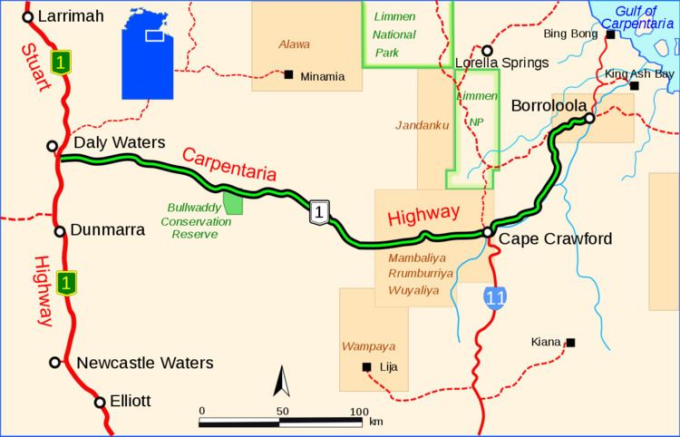
The Carpentaria Highway is a 380-kilometre-long (240 mi) highway, which runs from near Daly Waters to Borroloola in the Northern Territory, Australia. It is a sealed road and is part of National Highway 1. The Highway takes its name from the Gulf of Carpentaria, which it links with the Stuart Highway. The Carpentaria Highway also provides road access to the McArthur River mineral deposits and port facilities at Bing Bong, as well as the isolated community of Borroloola and the popular fishing location at King Ash Bay. Funding for maintenance is provided by the Northern Territory government.
Contents
- Caravan coming into calvert river bush camp carpentaria highway nt
- Map of Carpentaria Hwy Northern Territory Australia
- Rough road section carpentaria highway borroloola surprise creek to calvert river
- References
Map of Carpentaria Hwy, Northern Territory, Australia
Rough road section carpentaria highway borroloola surprise creek to calvert river
References
Carpentaria Highway Wikipedia(Text) CC BY-SA