
Primary outflows Carlingwark Lane Max. length .075 mi (0.121 km) Surface elevation 44 m Length 121 m Catchment area 13.05 km² | Primary inflows Max. width 0.33 mi (0.53 km) Mean depth 2.1 m Width 530 m Catchment area 13.05 km² | |
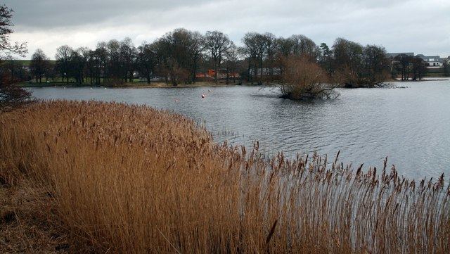 | ||
Carlingwark Loch is a small freshwater loch in Dumfries and Galloway, Scotland lying just south of Castle Douglas and is roughly rectangular in shape, trending nearly north and south. The name of the loch comes from the Scots Gaelic word Caer meaning fort and wark the old Scots language word for work. There are four artificial islets in the loch showing evidence of fortification and settlement, Ash Island is thought to be a crannog. Several archaeological finds have been retrieved from the loch including a bronze cauldron, sword and pan and two dugout canoes.
Map of Carlingwark Loch, Castle Douglas, UK
There is a 5.25 km (3.26 mi) footpath around the loch and it is popular for bird watching and fishing. As of 5 March 2012 the loch and the land around it has been designated as a Scottish Site of Special Scientific Interest on account of its varied birdlife and grassland.
In 1903 the loch was surveyed by E.R. Watson and later charted as part of The Bathymetrical Survey of Fresh-Water Lochs of Scotland 1897–1909.
In 2009 an aerating fountain was installed at a cost of £10,000 to try to prevent the build-up of blue-green algae. The funding was provided by South West Scotland Environmental Action Trust. The installation of the fountain was part of a wider development of Carlingwark Outdoor Activity Centre by Dumfries and Galloway Council.