
Local time Thursday 11:23 PM | ||
 | ||
Weather 13°C, Wind SW at 6 km/h, 94% Humidity | ||
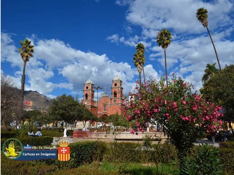
Carhuaz is a town in Peru located in the Ancash Region, Carhuaz Province, Carhuaz District. It is situated at 34 km from Huaraz, at 2,688 msnm. Its temperature average is from 12 to 14 degrees Celsius. Near this city, the hot springs of Monterrey and the airport of Anta are located.
Map of Carhuaz, Peru
The streets of the city of Carhuaz, capital of the province of Carhuaz which was created by law 7951 of December 14, 1934, are similar to those of the other cities of the Callejón de Huaylas. Its name derives from qarwash which means yellow, that is to say, the color of the retama flowers (broom flowers) that covers the hills that are contiguous to the city.
From its main square, the snow-capped mountain Wallqan (6,126 m) is discerned. This mountain is known as the second Waskaran. The city keeps on having still a Hispanic and colonial style, keeping its old casonas.
The zone, located in the right margin of the Santa river, has a moderate and agreeable climate. It also has abundant agricultural products, especially fragrant fruits. In the surroundings, there are propitious places for hunting tarukas, partridges and viscachas, as well as for fishing trout.
At 8 km to the south of Carhuaz the village Marcará is located from where a road of 4 km departs. This road leads to the mineral-medicinal fountains of Chancos which curative virtues have deserved the epithet of <