
 | ||
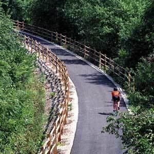
The Cardinal Greenway is a rail trail that encompasses 60 miles (97 km) of abandoned CSX railroad corridor in east central Indiana. The trail runs from Richmond to Marion and is the longest rails-to-trails project in Indiana as of 2004. The Cardinal Greenway was designated a National Recreation Trail in June 2003 and is an important part of the American Discovery Trail.
Contents
- Map of Cardinal Greenway Marion IN 46953 USA
- Name
- Sponsor
- History
- Route
- Richmond Section
- Planned Richmond Muncie Construction
- Planned Richmond Losantville Construction
- Losantville Mt Pleasant Construction
- Trailheads
- Mt Pleasant Muncie Gaston Section
- Gaston Jonesboro Gap
- Gaston Jonesboro County Road Route
- Jonesboro Marion Section
- Beyond Marion
- Connections With Other Trails
- Map
- References
Map of Cardinal Greenway, Marion, IN 46953, USA
Name
Cardinal Greenway takes its name from the last passenger train to regularly travel the route (Chicago-Cincinnati-Washington): the Cardinal. The train service in turn derived its name from the state bird of all five states which it traversed.
Sponsor
The trail is managed by Cardinal Greenway, Inc., formerly known as Delaware Greenways, Inc. The company is organized under federal tax regulations as a 501(c)(3) not-for-profit organization. Its mission statement is as follows:
Cardinal Greenway, Inc. is dedicated to enhancing the quality of life by developing and operating corridors and trails to connect people and communities.
History
In 1993, over 200 people responded to a small newspaper item saying there would be a meeting to investigate the possibility of purchasing an abandoned rail line for a rails-to-trails conversion project. (Rail removal had begun on said line in Fall of 1992. Work started in Marion and was completed from there through Richmond by June 1993.) Cardinal Greenway, Inc., a not-for-profit, was formed, and it purchased 60 miles (97 km) of the former railroad corridor from CSX Corporation in that same year (1993). In 1996 a Master Plan was completed and final tracings were submitted to INDOT.
Groundbreaking took place in September 1997, marking the start of Phase 1, a 10-mile (16 km) Muncie section from the Wysor Street Depot to County Road 534 East. The 8-mile (13 km) Jonesboro-Marion section and the 2.5-mile (4.0 km) Richmond section were constructed sometime before 2003. The 10-mile (16 km) Muncie-Gaston section was constructed around 2003.
On Thursday, June 5, 2003, the Cardinal Greenway was designated a National Recreation Trail.
The 7-mile (11 km) Losantville-Mt. Pleasant section was opened in a ribbon-cutting ceremony held in Losantville on April 19, 2007. Governor Mitch Daniels helped cut the ribbon.
On Tuesday, May 20, 2008 Governor Mitch Daniels announced grants which include work on the Richmond-to-Losantville section (improving six bridges, among other work) and the Sweetser Switch Trail Connector (connecting the two trails along an abandoned railroad corridor).
Route
The trail starts in Richmond, travels through Wayne, Randolph, Henry, Delaware, and Grant counties, and ends in Marion.
The trail is paved with asphalt.
Richmond Section
The trail begins with a 2.5 miles (4.0 km) section on the north side of Richmond. This is near the Whitewater River.
Planned Richmond-Muncie Construction
The Richmond section and the Muncie section planned to be joined in the future. The total of the lengths of the Richmond section, the new section, and the Muncie section will be “around 52 miles (84 km)”.
The constructed link will go through Losantville.
Planned Richmond-Losantville Construction
This planned route, 20.6 miles (33.2 km) from Industries Road to Losantville, will go under I-70 and through the town of Economy.
This is the curviest segment of the former railroad corridor.
Losantville-Mt. Pleasant Construction
This 7-mile (11 km) section (2 miles (3.2 km) in Randolph County, 3½ miles in Henry County, and 1½ miles in Delaware County) will go through Blountsville and will probably parallel U.S. Route 35 most of the way.
Trailheads
(Mt. Pleasant-) Muncie (-Gaston) Section
This is the longest completed section, offering 20 miles (32 km) of paved trail with trailheads, rest areas, and interpretive signage. All rest areas and trail heads are handicapped accessible.
This section picks up the trail at the intersection of S 534 E and E 700 S, southeast of the Prairie Creek Reservoir. This area has 10 miles (16 km) of adjacent horse trail.
The Cardinal Greenway then travels into the heart of Muncie, bisecting with Wysor Street Depot in the middle. Just to the north of the depot the Cardinal Greenway intersects the White River Greenway.
The trail continues out of Muncie to Gaston. It is about 10 miles (16 km) from the depot to the trailhead in Gaston.
Trailheads
Gaston-Jonesboro Gap
An 11.3-mile (18.2 km) section of the former rail corridor, going from Gaston to Jonesboro and running through Fowlerton, is owned by private land owners. Cardinal Greenways, Inc. states that a route “will be chosen using public roads to connect the two sections of Cardinal Greenway.” IndianaTrails.org states that “[t]he county road route can be followed using Dan Henry-style pavement markers.”
Gaston-Jonesboro County Road Route
The route connects around the gap by following 17.2 miles (27.7 km) of county roads. From the Gaston trailhead, it continues
where the greenway resumes (at the first left after Boyd Street).
(Jonesboro-) Marion Section
This section of the route is 8 miles (13 km) in length.
The trail resumes in Jonesboro at East 10th Street. From there it travels along the Mississinewa River until it crosses US-35/IN-22. By East 4th Street in Jonesboro, there is a pedestrian bridge over the Mississinewa to the Eugene “Beaner” Linn Park, a 90-acre (360,000 m2) park in Gas City.
After crossing US-35/IN-22, the trail goes on into Marion, going by Hogin Park, through the short tunnel under South D Street, under “the bypass” (IN-9), and ending at South Miller Avenue.
Trailheads
Beyond Marion
Plans were announced on October 16, 2007 to expand the Cardinal Greenway 3 miles (4.8 km) west to the Sweetser Switch Trail in Sweetser, and perhaps eventually to Converse in Miami County.
Connections With Other Trails
The Cardinal Greenway is part of the Northern Route of the American Discovery Trail.
The Cardinal Greenway connects to the White River Greenway just north of the Wysor Street Depot near downtown Muncie. Current expansion is underway to construct a larger White River Greenway trail along Wheeling Road north of downtown Muncie.
In Richmond, the trail connects to the Whitewater Gorge Trail and Gennett Walk of Fame in the Whitewater Gorge Park.
Map
The map included here show Delaware County and surrounding areas. For more complete maps of the entire length of the trail visit the Indiana Trails site.