
Country United States FIPS code 18-38862 Area 231 ha Zip code 46938 Local time Monday 2:16 PM | Time zone EST (UTC-5) GNIS feature ID 0437105 Elevation 260 m Population 1,722 (2013) Area code 765 | |
 | ||
Weather -3°C, Wind E at 18 km/h, 84% Humidity | ||
Jonesboro is a city in Grant County, Indiana, United States, located along the Mississinewa River opposite Gas City. The population was 1,756 at the 2010 census.
Contents
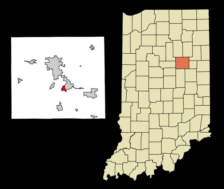
Map of Jonesboro, IN, USA
History
Jonesboro was established in 1837 by Obadiah Jones, and named for him.
Geography
Jonesboro is located at 40°28′46″N 85°37′47″W (40.479340, -85.629847).
According to the 2010 census, Jonesboro has a total area of 0.89 square miles (2.31 km2), all land.
2010 census
As of the census of 2010, there were 1,756 people, 684 households, and 486 families residing in the city. The population density was 1,973.0 inhabitants per square mile (761.8/km2). There were 770 housing units at an average density of 865.2 per square mile (334.1/km2). The racial makeup of the city was 97.7% White, 0.1% African American, 0.5% Native American, 0.6% from other races, and 1.2% from two or more races. Hispanic or Latino of any race were 2.4% of the population.
There were 684 households of which 34.9% had children under the age of 18 living with them, 49.6% were married couples living together, 14.9% had a female householder with no husband present, 6.6% had a male householder with no wife present, and 28.9% were non-families. 23.8% of all households were made up of individuals and 9.2% had someone living alone who was 65 years of age or older. The average household size was 2.57 and the average family size was 2.94.
The median age in the city was 39 years. 25.8% of residents were under the age of 18; 8.2% were between the ages of 18 and 24; 24.4% were from 25 to 44; 26.9% were from 45 to 64; and 14.9% were 65 years of age or older. The gender makeup of the city was 48.5% male and 51.5% female.
2000 census
As of the census of 2000, there were 1,887 people, 768 households, and 545 families residing in the city. The population density was 2,221.8 people per square mile (857.1/km²). There were 817 housing units at an average density of 961.9 per square mile (371.1/km²). The racial makeup of the city was 97.51% White, 0.16% African American, 0.26% Native American, 0.05% Asian, 1.01% from other races, and 1.01% from two or more races. Hispanic or Latino of any race were 1.75% of the population.
There were 768 households out of which 32.4% had children under the age of 18 living with them, 54.6% were married couples living together, 12.8% had a female householder with no husband present, and 29.0% were non-families. 25.0% of all households were made up of individuals and 8.2% had someone living alone who was 65 years of age or older. The average household size was 2.46 and the average family size was 2.91.
In the city, the population was spread out with 25.4% under the age of 18, 7.6% from 18 to 24, 29.4% from 25 to 44, 24.3% from 45 to 64, and 13.3% who were 65 years of age or older. The median age was 37 years. For every 100 females there were 90.2 males. For every 100 females age 18 and over, there were 90.1 males.
The median income for a household in the city was $36,974, and the median income for a family was $42,036. Males had a median income of $33,611 versus $21,042 for females. The per capita income for the city was $16,723. About 4.1% of families and 6.5% of the population were below the poverty line, including 6.2% of those under age 18 and 5.6% of those age 65 or over.
Notable person
Harry Knight, Indy car driver