
Postcode(s) 2650 Postal code 2650 | County Wynyard Elevation 551 m Local time Friday 8:16 AM | |
 | ||
Location 468 km (291 mi) from Sydney71 km (44 mi) from Wagga Wagga22 km (14 mi) from Kyeamba16 km (10 mi) from Rosewood Weather 18°C, Wind SE at 6 km/h, 73% Humidity | ||
Carabost is a foresting community in the south east part of the Riverina. It is situated about 16 kilometres north west from Rosewood and 22 kilometres south east from Kyeamba.
Map of Carabost NSW 2650, Australia
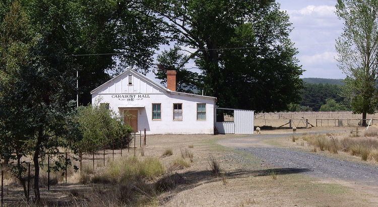
Carabost can be found on the Tumbarumba Road near the location of the Carabost National Forest - a large Pine Plantation in the area. The only facilities available in the area, other than the Carabost Town Hall built in 1927, and a Fire Brigade Shed, is a public telephone box and a post box - both at the same location as the district emergency gathering point which is used in the case of forest fire or similar emergency.
Carabost is the Gaelic form of Carbost on the Scottish island of Skye and means Copse farm.
Carabost Post Office opened on 1 March 1879, in which it closed on 4 March 1897, it then reopened on 1 January 1915 and was closed once again on 27 January 1968