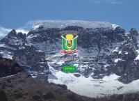
UBIGEO 2103 | Elevation 4,315 m (14,157 ft) Area 12,266 km² Region Puno Region | |
 | ||
Website www.municarabaya.gob.pe | ||
Carabaya Province is a province of the Puno Region in the southern part of Peru. It is bounded on the north by the Madre de Dios Region, on the east by the Sandia Province, on the south by the provinces of Azángaro, Melgar and Putina and on the west by the Cusco Region. The capital of the province is the city of Macusani.
Contents
Map of Carabaya Province, Peru
Geography
The province is traversed by the Willkanuta and Kallawaya mountain ranges. Some of the highest peaks of the province are Allin Qhapaq, Ch'ichi Qhapaq and Pumanuta. Other mountains are listed below:
Ariquma Lake, Wiluyuq Qucha and Sayt'uquta belong to the largest lakes of the province.
Political division
The province measures 12,266.4 square kilometres (4,736.1 sq mi) and is divided into ten districts:
Ethnic groups
The people in the province are mainly indigenous citizens of Quechua descent. Quechua is the language which the majority of the population (84.12%) learnt to speak in childhood, 15.14% of the residents started speaking using the Spanish language and 0.62% Aymara (2007 Peru Census).
