
Opening date December 1964 (dam) Opened December 1964 Construction began April 1961 | Length 535 m | |
 | ||
Similar Ohio River, Markland Locks and Dam, Greenup Lock and Dam, Cannelton Locks and Dam, Phillips' Folly | ||
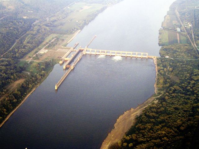
The Captain Anthony Meldahl Locks and Dam is a non-navigable river control dam with an associated lock, located at mile marker 436 on the Ohio River. It was named for Captain Anthony Meldahl, a river captain.
Map of Captain Anthony Meldahl Lock and Dam, Felicity, OH 45120, USA
The dam has a top length of 1,756 feet (535 m) with a 372-foot (113 m) fixed weir and a 310-foot (94 m) open crest. At normal pool elevation the length is 95 miles (153 km) upstream encompassing an area of 21,700 acres (88 km2). The facility is operated by the United States Army Corps of Engineers.
Currently there is a joint venture between Baker Concrete and Alberici Constructors to build a three turbine hydroelectric plant and spillway addition to the Meldahl Locks and Dam.
References
Captain Anthony Meldahl Locks and Dam Wikipedia(Text) CC BY-SA