
Area 222.9 km² Phone +1 844-435-9453 | Governing body BC Parks Established 1973 | |
 | ||
Similar God's Pocket Marine Pr, Winter Harbour Lodge, Outpost At Winter Harbour, God's Pocket Resort, Last Resort Bed & Breakfast | ||
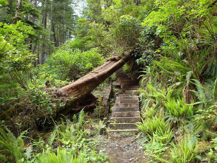
North coast trail cape scott provincial park bc canada
Cape Scott Provincial Park is a provincial park located at the cape of the same name, which is the northwestern tip of Vancouver Island, British Columbia, Canada. First established in 1973 with about 37,200 acres (15,100 ha), later boundary revisions increased this to 22,290 hectares (55,100 acres). Lanz and Cox Islands Provincial Park, formerly Scott Islands Marine Provincial Park, is offshore, to the northwest of Cape Scott.
Contents
Cape scott provincial park bc adventure series episode 1
Geography
The park is known for its old growth forest and sandy beaches. The terrain is rugged and the area is known for its heavy rain and violent storms.
The park's highest point is Mt. St. Patrick, 422 metres (1,385 ft) above sea level. The park's largest lake is Eric Lake, at 44 hectares (110 acres).
Most of the park is in the Nahwitti Lowland, a subunit of the Hecate Depression, part of the Coastal Trough.
The former settlement of Cape Scott, which was founded by Danish-Canadian immigrants, is located within the park at 50°47′00″N 128°20′00″W at the head of Hansen Lagoon. Another related settlement in the area is Strandby, named after a coastal village in Denmark and located facing Shuttleworth Bight at 50°50′15″N 128°08′20″W.
History
The Kwakwaka'wakw First Nations created trails through the area that includes the park, using these trails for trade, to harvest resources, and to visit locations that were considered sacred. Three First Nations reserves are within the park, including the former village of Nahwitti.
In 1786, the area was given the name "Cape Scott" in honour of David Scott, a merchant from Bombay who had backed a trading voyage to the cape. From 1897 until 1910, Danish settlers tried to establish a fishing community near San Josef Bay. Due to the harsh climate and lack of governmental support, the community failed and most settlers left the area. Following that, another attempt was made at Hansen Lagoon, similarly failing by 1917. Alfred Spencer, the last resident, left in 1956.
Some artifacts can still be seen in the park, including a three-metre-tall granite tombstone, several corduroy roads, many ruins (that look like anonymous mossy mounds), and rusty farming implements.
Recreation
The park is a popular destination for backpackers during the less rainy summer season. A logging road connects the towns of Port Hardy and Holberg to the southern end of the park. The rest of the park is accessible only by foot, helicopter, or boat. A popular backpacking trip is to hike the 16.8 km Cape Scott Trail to Nels Bight, which typically requires 4–7 hours each way and is rated as easy/moderate in difficulty. It is mostly flat, but is often very muddy. Much of the trail consists of wooden boardwalk. The 43.1 km North Coast Trail, which opened in 2008, is an extension to the Cape Scott Trail. It has some very difficult sections in the east, and more moderate terrain in the west.
There are multiple campsites with pit toilets, metal food caches, and wooden tent platforms along the original Cape Scott trail and the North Coast Trail. For day hikers looking for a shorter trail (less than an hour each way), there is a path out to the beach at San Josef Bay.