
 | ||
Similar Punta La Entallada Lighthouse, School of Salamanca, Perejil Island, Anti‑Atlas, High Atlas | ||
Cape Juby (Arabic: رأس جوبي, trans. Ra's Juby, Spanish: Cabo Juby) is a cape on the coast of southern Morocco, near the border with Western Sahara, directly east of the Canary Islands. According to the Moroccan Embassy it is of Berber origin with no specific meaning.
Contents
- Map of Cap Juby Tarfaya Morocco
- Precolonial era
- Spanish Sahara
- Retrocession to Morocco
- Sahara sea
- References
Map of Cap Juby, Tarfaya, Morocco
Its surrounding area, called Cape Juby Strip or Tarfaya Strip, while making up presently the far South of Morocco, is in a way a semi-desertic buffer zone between Morocco proper and the Western Sahara, and was under Spanish rule in the first half of the 20th century.
Precolonial era
On May 28, 1767, Mohammed ben Abdallah, the Sultan of Morocco, signed a peace and commerce treaty with King Charles III of Spain. In the treaty, Morocco did not guarantee the security of Spanish fishermen in the coasts south of the Nun river, as Morocco did not have control over the Tekna tribes of that area (Art. 18).
On March 1, 1799, Sultan Slimane of Morocco signed an accord with King Charles IV of Spain, in which he recognized that the Saguia el Hamra and Cape Juby regions were not part of his dominions (Art. 22).
In 1879, the British North West Africa Company established a trading post near Cape Juby called "Port Victoria". On March 26, 1888, Moroccan soldiers attacked the post, killing the director of the post and leaving two workers badly injured. In 1895, the company sold its post to the Sultan of Morocco.
Spanish Sahara
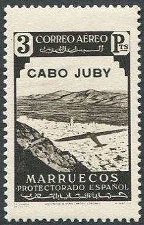
In 1912, Spain negotiated with France (which controlled the affairs of Morocco at the time) for concessions on the southern edge of Morocco. Francisco Bens officially occupied the Cape Juby region for Spain on July 29, 1916. It was administered by Spain as a single entity with Spanish Sahara and Ifni, as Spanish West Africa.
The Spanish area 12,700 sq mi (33,000 km2), and had a population of 9,836. Its main town was founded by the Spanish as Villa Bens (now called Tarfaya). Villa Bens was used as a staging post for airmail flights.
Retrocession to Morocco
When Morocco became independent in 1956, it asked for the cession of Moroccan areas controlled by Spain. After some resistance and some fighting during 1957 (the Ifni War), the Cape Juby strip was ceded by the Spanish government to Morocco in 1958.
Sahara sea
In 1877, English engineer Donald Mackenzie was the first to propose a Sahara Sea be created. Mackenzie proposed cutting a channel from Cape Juby in southern Morocco to a large basin and plain known as El Djouf. This basin was approximately 61 metres (200 ft) below sea level at its deepest, and would have created an inland sea 155,400 square kilometres (60,000 sq mi) in area. Indeed, geological evidence suggested that this basin had previously been connected to the Atlantic Ocean via a channel near Sakiet el-Hamra.It was further proposed that this inland sea, if augmented with an inland canal, could provide access to the Niger River.
Mackenzie acknowledged that other desert basins in present-day Tunisia, Algeria and Egypt shared below-sea-level profiles similar to those observed at El Juf. These basins contained seasonally dry salt lakes, known as chotts. The Qattara Depression is perhaps the largest area in North Africa below sea level.