
Established 1765 Population 952 (2011) | Time zone AST (UTC-4) | |
 | ||
History
Canning Parish set off from Waterborough Parish in 1827: named for the Right Honourable George Canning, (1770–1827) who was prime minister of the United Kingdom: included part of Chipman Parish until 1835.
Delineation
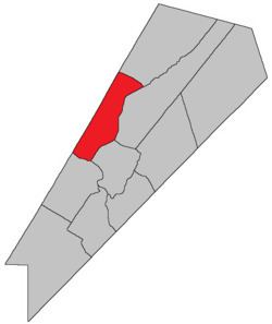
is defined in the Territorial Division Act as being bounded:
Northeast by Chipman Parish; northwest by the County line; southwest by the Saint John River, and southeast by Cambridge and Waterborough Parishes.Communities
Parish population total does not include incorporated municipalities (in bold).
Bodies of water & Islands
This is a list of rivers, lakes, streams, creeks, marshes and Islands that are at least partially in this parish
Access Routes
Highways and numbered routes that run through the parish, including external routes that start or finish at the parish limits:
References
Canning Parish, New Brunswick Wikipedia(Text) CC BY-SA