
Country Canada Area 3,682 km² Local time Tuesday 6:09 AM Area code 506 | Established 1785 Time zone AST (UTC-4) Population 11,086 (2011) | |
 | ||
Weather -8°C, Wind N at 5 km/h, 86% Humidity | ||
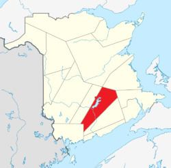
Queens County (2011 population 11,086) is located in central New Brunswick, Canada. The county shire town is the village of Gagetown.
Contents
Map of Queens County, NB, Canada
Geography
The county's geography is dominated by the Saint John River and Grand Lake. Coal mining is a major industry in the Minto area. Forestry and mixed farming dominate the rest of the county. The CFB Gagetown military training area takes in a large portion of the western part of the county.
Communities
There are four municipalities within Queens County (listed by 2011 population):
Parishes
The county is subdivided into ten parishes (listed by 2011 population):
Major Highways
References
Queens County, New Brunswick Wikipedia(Text) CC BY-SA