
Time zone CET (UTC+1) Area 17.6 km² Patron saint Saint Sebastian | Elevation 25 m (82 ft) Dialing code +39 0184 Local time Tuesday 5:50 PM Postal code 18033 | |
 | ||
Frazioni Balloi, Brunetti, Ciaixe, Magauda, San Giacomo, Trinità Weather 16°C, Wind N at 18 km/h, 27% Humidity | ||
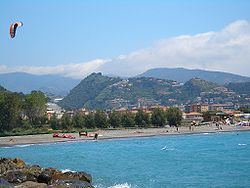
Camporosso is a comune (municipality) in the Province of Imperia in the Italian region Liguria, located about 160 kilometres (99 mi) southwest of Genoa and about 45 kilometres (28 mi) west of Imperia. As of 31 July 2008, it had a population of 5,562 and an area of 17.6 square kilometres (6.8 sq mi).
Contents
Map of 18033 Camporosso Province of Imperia, Italy
Geography
Camporosso borders the following municipalities: Dolceacqua, San Biagio della Cima, Vallecrosia, and Ventimiglia.
History
On 21 April 1686, the representants of eight villages, Camporosso, Vallebona, Vallecrosia, San Biagio della Cima, Sasso, Soldano, Borghetto San Nicolò and Bordighera had a meeting in order to build what they called "Magnifica Comunità degli Otto Luoghi", which can be translated as: "The magnificent community of the eight villages". Their goal was to gain independence from the nearby rival city of Ventimiglia.