
Country Italy Time zone CET (UTC+1) Elevation 1,450 m Postal code 86027 | Demonym(s) Campitellesi Dialing code 0874 Dialling code 0874 | |
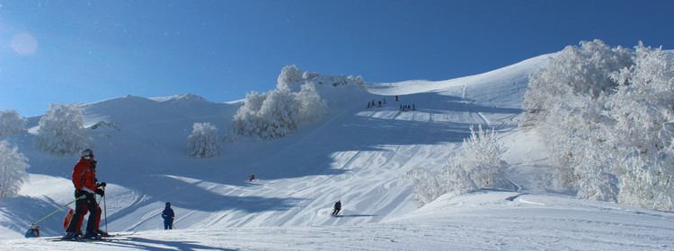 | ||
Campitello matese pista del caprio 06 12 2015
Campitello Matese is an Italian civil parish (frazione) and ski resort, part of the municipality of San Massimo in the province of Campobasso, Molise region.
Contents
- Campitello matese pista del caprio 06 12 2015
- Map of 86027 Campitello Matese Province of Campobasso Italy
- Gopro hero 3 silver snowboard campitello matese 03 01 2016
- History
- Geography
- Tourism and sport
- References
Map of 86027 Campitello Matese, Province of Campobasso, Italy
Gopro hero 3 silver snowboard campitello matese 03 01 2016
History
Still 1960s Campitello had only a building used as shelter for shepherds. In the 1970s it started the realization of the first plants to transform it in a ski resort.
Geography
Campitello lies nearby Miletto mountain, part of the Matese mountain range, close to the borders of Molise with Campania. Nearest municipalities are San Massimo, Bojano, Cantalupo nel Sannio and San Gregorio Matese (CE, at the southest side of the mountains.
Tourism and sport
As ski area, Campitello is strongly receptive for Tourism, especially during winter. The resort has got 2 chairlifts and 7 ski plants for a total length of 40 km
Campitello Matese is a location known to cycling fans for being several times during the coming stage of the Giro d'Italia: the first in 1969, the last in 2002. The characteristics of the ascent from San Massimo Campitello (13.5 miles long and 850 m in altitude, average slope of 6.4%) make it one of the most challenging uphill finishes of the Apennines.